


May
About the image
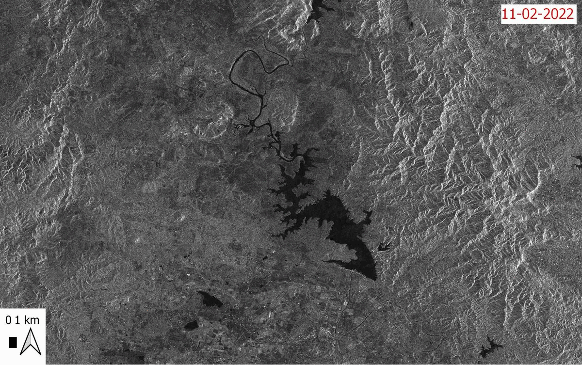
This before-and-after animation shows an increase in the area covered by water around the town of Coominya, in southeast Queensland. The water bodies appear as dark features, with Wivenhoe Dam the largest of these smooth-surfaced features. In contrast, the mountainous terrain of D’Aguilar National Park, to the east of the dam, shows as lighter shades of grey. The two images were captured before and after a late-summer weather event that became known colloquially as the “rain bomb”.
Detection of water bodies with radar-based satellite imagery
Satellite-borne radar sensors record information on Earth’s surface in practically all-weather conditions, day, and night. These sensors emit a pulse of microwave energy to detect objects, a similar energy used by microwave ovens to heat food. Scientists study the shape or condition of the objects by the amount of energy that is reflected to the sensor (‘backscatter’). The time delay measured between the emitted and backscattered signals is used to calculate the distance to an object (Solbo and Solheim, 2004).
Many radar systems record information via an antenna that receives the backscattered signal. The length of the antenna is directly proportional to the level of detail captured: in other words, the longer the antenna, the smaller the objects that are identifiable on the ground. For example, if scientists need to accurately identify urban developments or crops, they may need a 10-m pixel size, which might require a 4000-m antenna! It is not practical to have such a long antenna on sensors mounted on orbiting satellites. The development of Synthetic Aperture Radar (SAR) systems was a clever solution to this problem, whereby a shorter antenna captures and combines a sequence of acquisitions that mimic a larger antenna.
SAR images are eminently useful for detecting water bodies. The reason water appears so dark in the image above is that its surface is very flat. When the sensor’s energy beam hits the water surface, the energy largely scatters away from the sensor, rather than reflecting back to the sensor. SAR images are particularly useful for this type of application when rainclouds obscure the ground from other types of satellite sensors.
By comparing water-body detections between two dates of imagery, we can estimate the extent of additional water in the landscape that resulted from the rain bomb. For example, in this image subset, we estimated that the extent of water bodies increased by 2800 hectares.
Technical details
Sentinel-1 is a satellite space mission operated by the European Space Agency. The mission consists of two satellites, Sentinel 1-A and 1-B, launched in 2014 and 2016, respectively, carrying SAR sensors. The above pair of Sentinel 1-A SAR satellite images (C-band) on 11 February and 7 March 2022 are currently stored at Queensland’s Remote Sensing Centre.
Processing SAR imagery is complex and requires specialized algorithms. Sentinel-1 images come with different sensor configurations, types of energy recorded, and orbits. To make the images comparable, scientists filtered the pair of images into homogeneous subsets at: 1) 10-m pixel size, 2) single co-polarization, and 3) descending orbit (i.e. the satellite crossed the equator from north to south). Images were pre-processed by: 1) removing noise, 2) converting raw data to decibels (a physical measure of sound level that quantifies the backscattered signal), 3) aligning images to ground geographic locations (orthorectification), and 4) correcting for terrain effects.
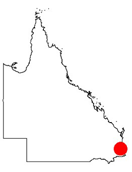
The approximate location of the image is marked by the red dot in the map of Queensland (right).
Reference
Solbo., S and I. Solheim (2004): Towards operational flood mapping with Satellite SAR. Proceedings of the 2004 Envisat & ERS Symposium, Austria 6-10 September 2004, Salzburg.