Remote sensing
Remote sensing scientists analyse data from satellites, airborne and ground-based platforms to map and monitor Queensland’s landscape.
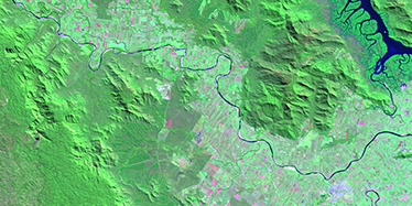
Remote sensing scientists create state-wide image products representing land use, groundcover, vegetation change, fire scars and water bodies.
Leading-edge research to improve existing monitoring activities and to develop new applications is undertaken in collaboration and partnership with universities, as well as other science organisations.
Remote sensing imagery and derived datasets are used to support and inform a wide range of policy, planning and compliance activities. The wider community also recognises that remote sensing is an extremely useful tool for environmental, land and resource management. Our imagery, maps and datasets are used by regional natural resource management groups, industry groups, research agencies, local government and landholders for planning, risk assessment and decision-making.