Using historical aerial photos to manage encroachment in grasslands
Encroachment is the expansion of woody vegetation onto native grassland regional ecosystems far exceeding its natural range.
Prior to European settlement, the woody vegetation in native grasslands expanded and contracted over time, due to seasonal conditions and periodic burning. Since European settlement, land management has largely removed fire from the environment, and the introduction of sheep and cattle has resulted in the progressive expansion of woody vegetation onto some grassland regional ecosystems.
Clearing in grassland regional ecosystems
The rules for clearing woody vegetation depend on the regional ecosystem mapped on your land.
Unregulated and regulated grasslands
Unregulated grasslands are identified as having a 'grassland' structure category in the vegetation management regional ecosystems description database, VM REDD.
Regulated grasslands are identified as having a 'woody grassland' structure category in the VM REDD.
Clearing in an unregulated grassland regional ecosystem is exempt from vegetation management requirements.
To manage encroachment under the 'Managing encroachment' clearing code, you must first demonstrate that encroachment has occurred.
The Guide to using the encroachment code 962.1 KB) provides more information on how to demonstrate encroachment, encroachment regional ecosystems and how to locate them on your land.
Using maps and aerial images to identify regional ecosystem boundaries
The vegetation management supporting map provides regional ecosystem boundaries and the VM REDD provides regional ecosystem descriptions and structure categories. Comparing this information with aerial imagery can help confirm the location and type of regional ecosystems at a property scale.
Accessing maps
- You can request a free vegetation management property report online.
- You can view vegetation management maps interactively online using the Queensland Globe.
- To provide ongoing certainty, mapped regional ecosystems can be confirmed by applying for a property map of assessable vegetation (PMAV).
You should seek advice from the Vegetation Hub on 135 VEG (135 834) or engage an environmental consultant when trying to determine if regional ecosystems and their mapped boundaries are correct, and for submitting a PMAV application.
Using historical aerial imagery to detect encroachment
You can use aerial photographs and satellite imagery to help determine boundaries between unregulated grasslands and regulated grassland regional ecosystems, and to demonstrate encroachment.
As encroachment involves a change in structural formation from grassland to native shrubland or woodland, it is readily detectable on aerial imagery. A comparison of historical and recent imagery can identify encroachment of a woody species.
Accessing historical aerial photos
You can access historical aerial photos online via the Geoscience Australia Historical Aerial Photography Collection.
The landholder guide Using the Geoscience Australia Imagery Portal to access historical aerial photos 1.8 MB) gives you step-by-step instructions to access the photo collection, identify an area of interest and download aerial photos for a given date.
Baseline images to show regional ecosystem boundaries
Imagery from the 1950s is recommended by the Queensland Herbarium as the best evidence for defining grassland boundaries because this date aligns with the end of a prolonged drought, and it is regarded as a baseline for the minimal extent of wooded vegetation associated with grassland regional ecosystems.
Not all images are available digitally, as some may still need to be scanned from the original film used. Imagery from the 1960s and onwards will suffice if 1950s photos are unavailable.
Find out more in the Queensland Herbarium guide, 'Methodology for surveying and mapping regional ecosystems and vegetation communities in Queensland', link available from Survey and mapping ecosystems.
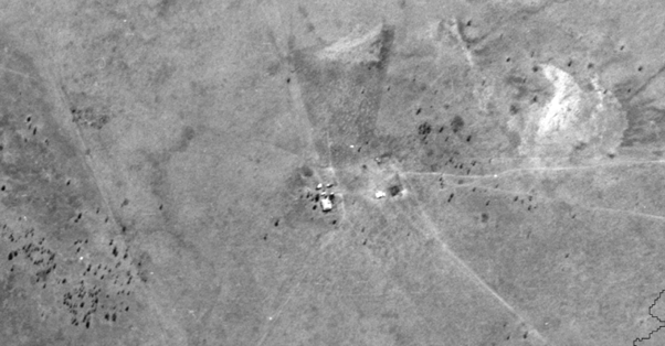
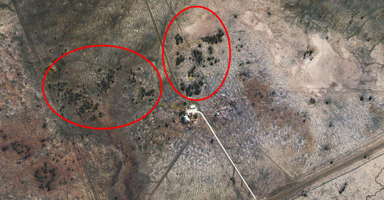
Image requirements under the encroachment code
The encroachment code stipulates that:
- recent imagery must not be older than 15 years (i.e. taken less than 15 years ago)
- historical imagery must be older than 15 years (i.e. taken more than 15 years ago).
Regardless of what kind of imagery you use, the encroachment code requires that it meets certain minimum standards of quality. These minimum standards are that historical imagery and recent imagery cover the same area and are at the same scale. The historical imagery and the recent imagery must exhibit both:
- evidence of scale
- identifiable areas (if present) of woody vegetation, grasses and bare earth.
Learn more about how we assess land clearing using satellite technology.
Next steps
Once you've identified regional ecosystems and any encroachment on your land, you can follow the step-by-step process for clearing under the code.