Survey and mapping ecosystems
The Queensland Herbarium is Queensland’s lead agency for survey, mapping and monitoring of the state’s vegetation and regional ecosystems, including wetlands and groundwater dependent ecosystems.
How is vegetation mapped?
Regional ecosystem mapping is based on field survey, analysis of aerial photographs and satellite imagery, and assessment of other data such as geology and soil mapping and historical survey plans.
The Herbarium maps both the pre-clearing and remnant extent of regional ecosystems. Information on remnant extent is maintained for the period from 1997 onward and is updated every two years.
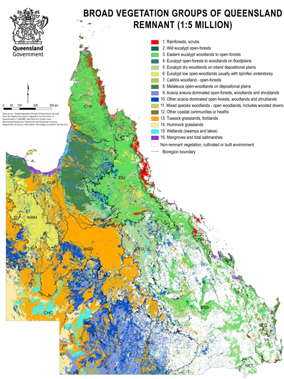
Regional ecosystems and remnant vegetation for most parts of Queensland are prepared at a scale of 1:100,000. Some areas, including parts of South East Queensland and the Wet Tropics bioregions, are mapped at finer scales of 1:50,000 or 1:25,000.
Details of the mapping process are available in the Methodology for Survey and Mapping of Regional Ecosystems and Vegetation Communities in Queensland.
Map uses
Regional ecosystem information and maps are essential tools for business, governments, landholders and organisations to plan and manage the natural environment, developments and vegetation restoration.
The mapping and regional ecosystem information is also used for the Vegetation Management Act, Environmental Protection Act and the Environment Protection and Biodiversity Conservation Act and to determine the status for each of the state’s 1,447 regional ecosystems.
Pre-clearing regional ecosystem mapping is also useful in planning restoration or revegetation, including projects that re-establish native vegetation for carbon and other benefits.
Regional Ecosystem mapping also underpins the mapping of Wetlands and Groundwater Dependent Ecosystems across Queensland.
How are wetlands mapped?
Wetland mapping is based on the collation, processing, updating, and integration of wetland waterbody mapping derived from manual and automated interpretation of satellite imagery, vegetation mapping, and watercourse lines from topographic mapping. Wetland mapping contains three data sets: areas, lines, and points.
Wetlands are further classified according to a range of criteria, including the wetland system (e.g., lacustrine, riverine, palustrine, etc.), water permanency, salinity, etc. All classification is consistent with the Interim Australian National Aquatic Ecosystem Classification Framework.
Details of the mapping process are available on WetlandInfo.
How are groundwater dependent ecosystems mapped?
Groundwater dependent ecosystems are ecosystems which require access to groundwater on a permanent or intermittent basis to meet all or some of their water requirements so as to maintain their communities of plants and animals, ecological processes and ecosystem services (Richardson et al. 2011).
Groundwater dependent ecosystem mapping builds on vegetation and wetland mapping to identify which ecosystems depend on groundwater and the nature of that dependence. Groundwater dependent ecosystem mapping is based on the collation, processing, updating, and integration of a range of source data including climate, ecology, hydrology, hydrogeology, geology, land type, etc. Groundwater dependent ecosystem mapping contains five data sets: areas, lines and points of ecosystems dependent on the surface expression of groundwater; areas of ecosystems dependent on the sub-surface presence of groundwater; and caves.
Details of the mapping process are available on WetlandInfo
How to access our maps
Regional ecosystem maps showing the biodiversity status and/or the broad vegetation group are available for free.
You can request a map online using property details or central coordinates.
You will then receive the map by email in portable document format (PDF).
Alternatively you can view the maps by regional ecosystems or broad vegetation groups on the Queensland Globe (biota globe). Wetland and groundwater dependent ecosystem maps can be viewed on the Queensland Globe (biota globe) and through WetlandMaps.
Note: These maps are not statutory and do not replace the vegetation management regional ecosystem maps.
How to access our mapping data
The Open Data portal provides geospatial and associated data for users of geographic information or similar systems.
Search for the term 'regional ecosystem', ‘wetland’, or ‘groundwater dependent ecosystem’ to find our data through the portal.
More information
- Queensland regional ecosystems
- Regional ecosystem descriptions database
- Remnant vegetation in Queensland
- Land zones of Queensland
- Fire management guidelines
- Regional ecosystem training guidelines
- Vegetation management
- Groundwater-dependent ecosystems
- Wetlands
Contact us for site survey data.