Topographic maps
A topographic map is a graphic representation of natural and man-made features on the ground. The maps are designed to show specific land information in a clear and unambiguous way.
Maps resulting from the early threat of war
Some of the first topographic maps of Queensland were produced as a result of the British fear of Russian expansion in the Pacific region, especially into the Australian colonies.
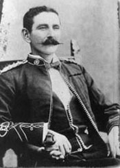
The first topographic map produced for the Colonial Government in Queensland was prepared in 1886 by Lieutenant Edwin Cave Owen from the Defence Force. This map covered the township of Fort Lytton and adjacent country.
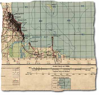
After Owen's original topographic map, maps of the Eagle Farm area were produced in 1889, followed by maps of the Cleveland–Wellington Point area in 1890.
Topographic maps produced by the military
As topographic maps were important in all military operations, the army pioneered this form of mapping in Australia.
In 1910, a survey section of the Royal Australian Engineers was formed and topographic maps in areas around Sydney, Melbourne and Adelaide were produced.
In 1915, the Australian Survey Corps was formed as a unit of the permanent military forces.
The First World War reinforced the need for good topographic map coverage of Australia. In 1920, a section of the Australian Survey Corps was sent to Queensland to carry out mapping operations.
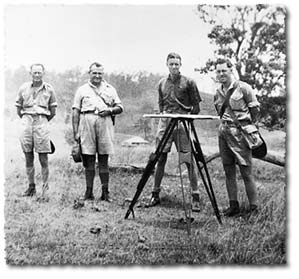
Preliminary procedures required that the surveyors first measured a base line on the Normanby Plains near Ipswich. This was followed by a second-order triangulation network covering South East Queensland.
In 1923, mapping performed by the Australian Survey Corps by plane table resulted in the publication of the first map sheet. This covered Beenleigh at a scale of one mile to an inch (1:63,360).
While surveying the D'Aguilar Range to the north-west of Brisbane in 1927, Captain Vance wrote to the Director of Military Operations. He outlined the difficulties he was having doing the survey by plane table. The Director informed him to continue his present mode of survey and encouraged the use of aerial photographs. The director also informed him that he would pass a request on to the RAAF to see if they could provide the aerial photographs.
By 1937 the work of topographers, Vance, Smith, Aldred and Rossiter had resulted in the publication of 13 map sheets.
World War Two
At the outbreak of World War Two, Queensland had very little topographic mapping coverage of the state. Queensland surveyor Captain Sam Ward and colleague Lieutenant Charlie Martin were tasked by the Army to form a unit of survey militia known as 1 Field Survey Company, which later became the 5th Field Survey Company. Queensland men from all walks of life joined this company, including surveyors, draftsmen, cooks, clerks, axe men, mechanics and labourers.
The 5th Field Survey Company in conjunction with other field survey companies produced a range of topographic map sheets which covered the Queensland coastline from Tweed Heads to Cape York.
National mapping council
In 1945, the National Mapping Council was established. It was determined that the Commonwealth Government and the Department of Defence would be responsible for a national topographic series and other less detailed products (1:50,000). This included 1:250,000 general reference topographic maps.
Other scales (1:50,000) were to be at the discretion of the states. The council was to oversee the states and ensure there was no duplication. This ended the army's monopoly on generating topographic maps.
In Queensland, topographic mapping was designed to complement the rapid development of the state's post-war infrastructure boom. It was aligned with a strong cadastral tradition.
In 1946, the second meeting of the Council was held in Adelaide. The discussion concerned specifications and allocation of aerial photography, geodetic triangulation, hydrographic surveys, guiding specifications for topographic mapping and general standards of map systems, projection, scales, and symbols.
Survey office establishes a topographic section
The topographic mapping activities of the Survey Office commenced after World War II with the establishment of the Topographic (Aerial Survey) Section.
In 1959, Cabinet authorised expansion of the topographic branch with the formation of 3 survey parties using modern EDM and additional office staff and equipment.
In 1962, the systematic topographic mapping of Queensland commenced using techniques developed during the war. The title of the first map published was Mirani D drawn at a scale of 1:31,680.
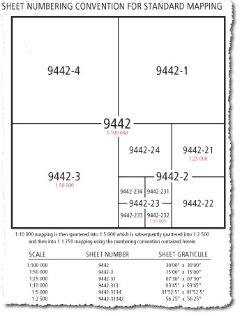
Standard format adopted
The ad hoc approach to project mapping in the 1960s and early 1970s evolved into a standard mapping program in 1977. The adoption of a standard base grid for all scales of mapping made it easier to plan project mapping and simpler for map users to identify map coverage.
Orthophoto maps
In 1977 monotone orthophoto maps began to be produced at a scale of 1:10,000. These were aerial images enhanced with cadastral and property information. The first maps covered the 1:100,000 areas of Caboolture, Esk and Ipswich and were available as printed copies. All future orthophoto maps at 1:10,000 were sold as dyeline copies.
Colour enhanced orthophotos at 1:25,000 were produced as duotones in 1979. This process then evolved into four colour topographic image maps in the early 1980s.
Methods of production
Two methods were employed simultaneously for a number of years to produce topographic maps.
- Those compiled using pen and ink were drawn at a scale of 1:16,667. They were then reduced two thirds at final negative stage for an output print scale of 1:25,000.
- The second method involved a previously prepared fair drawing which was photographically transferred onto a stud-registered negative emulsion. The contours and other line work were then scribed over precisely on separate overlays using sapphire tips specially machined to different widths. The sapphire tip lifted the emulsion, resulting in a new negative. This did away with the earlier positive generation. These 1:25,000 maps required no photographic reduction at the final negative stage. In time, scribing totally replaced pen and ink work.
In terms of text to be displayed on the maps, adhesive backed type for all nomenclature and miscellaneous text was affixed to predetermined stud-registered clear overlays according to final print colour. A negative was then generated from each overlay.
Halftone screen work was produced via the process of cutting a mask to the desired shapes on a rubylith overlay. This was then exposed together with a screen overlay photographically for each process colour.
Digital topographic mapping
The early 1990s saw a major upheaval in the way topographic mapping was undertaken and executed. Digital capture techniques completely replaced all manual forms of mapping. Map production procedures were revised accordingly.
In the mid 1990s procedures were set up for capturing digital topographic data. Photogrammetric plots each containing twelve control points were scan digitised externally. The resulting raster image was edited, filtered, cleaned and converted to two dimensional vector data using specialised software. This data was then manipulated into 3 dimensional software to facilitate the height component. Styles were applied within the software and topographic maps were generated.
Related links
- Learn about Queensland’s historical mapping processes.
- View images of instruments and equipment used to survey and map Queensland.