Thematic maps
Thematic maps have been used for centuries to map a particular theme within a geographic area (e.g. weather, population, tourism).
First general purpose maps
In 1860, the first map of the new state was produced privately, titled the Leopold Franz Landsberg's map. It was published at a scale of 14 miles to an inch (1:887,040) and covered the south-eastern part of the state north to Cape Palmerston.
The extent of mapping expanded when the entire state was covered at a scale of 41.25 miles to an inch (1:2,613,600) in 1863. This map also produced privately was called the Ham-Buxton's map.
The first official state map commissioned by the government was drawn by Thomas Ham and published in 1871. It was drawn at a scale of 24 miles to an inch (1:1,520,640).
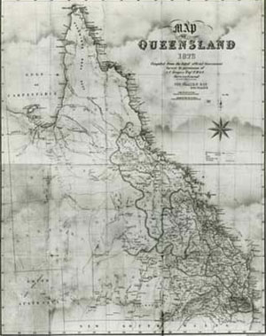
In 1877, the first school map of Queensland was published by the Education Department at a scale of 27 miles to an inch (1:1,710,720). It became a popular map and was often used as a base for displaying themed illustrations.
Variable themes for different mapping requirements
Printing stones for Queensland’s first electoral maps were prepared in 1887.
A geological map of Queensland and a map of Brisbane city and suburbs were published in the 1890s.
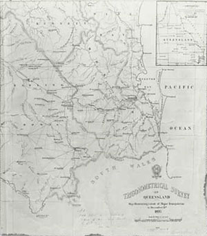
A concise trigonometrical survey map of south east Queensland was released in 1893. It showed the extent of major triangulation available at that time.
In 1896, the Survey Office published a very popular map titled Cyclists' road map of Brisbane and surrounding districts. This map was popular because it added detail such as signposts and the location of steep hills. A new coloured edition and very complete school map of Queensland, British New Guinea and northern New South Wales was released in the same year. At a scale of 27 miles to an inch (1:1,710,720) on 4 sheets, it showed mountains, rivers, districts, towns, roads and railways.
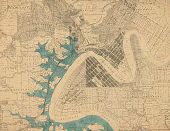
Flood maps of Brisbane were prepared in 1893 to show the areas flooded in the 1893 flood event.
In 1907, a 12 sheet series of a City of Brisbane and suburbs compilation was completed. This was based on more accurate trigonometrical and circuit surveys and was prepared at a scale of 8-chains to an inch (1:6,336).
Immediately prior to the First World War, the influence of the motorcar was having a dramatic effect on society. Along with a steadily increasing population and an improved road network, the demand for maps showing the formed roads began to increase.
Demand for maps during and following World War II
In 1942, a year after the United States entered the Second World War, the US Army Corps requested mapping coverage over Cairns, North Queensland. It was during this period that the major part of the mapping effort was directed towards the preparation of military maps.
At this time, Brisbane was remapped as an 8 sheet series and state electoral district maps were prepared.
In the 1950s and 1960s, land auction brochures were published to encourage the purchase of blocks of land.
Tourist maps
Prior to 1981, most mapping by the Queensland government mapping agency was related to land and property management, which saw the printing of cadastral and topographic maps.
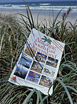
The 1982 the Commonwealth Games in Brisbane provided the momentum to attract a wider market of map users that were expected from the influx of visitors wanting to see Queensland attractions.
An Amazing series of tourist maps covering Queensland at various scales and coverage was subsequently produced.
By 1984, the then Department of Mapping and Surveying had adopted the Sunmap logo as a sales brand for the increasing range of thematic products. The branding became well known locally, nationally and to a significant extent internationally as a reputable source for purchasing maps.
The department experienced dynamic growth and innovation in themed maps during the lead up to Brisbane's World Expo '88.
The new range included regional maps, street and road maps, fishing guides, pocket maps, Japanese maps, island maps and even maps for other countries.
Related links
- Learn about Queensland’s historical mapping processes.
- View images of instruments and equipment used to survey and map Queensland.