Historical research resources

The Department of Resources is the custodian of the state's land and property information and the lead agency for spatial information and surveying in Queensland. Our information may help you with research into land history.

Land 101 - Guide to historical land research

Our guide to historical land research describes the main components of land administration in Queensland:

  • administrative areas, such as pastoral districts, counties, parishes and land agent’s districts (LADs)
  • property descriptions, including historical and current ways of describing urban and rural land
  • tenure types, such as freehold, leasehold and reserves.

The guide also explains where to find these components on maps, survey plans, land records, titles, gazettes and newspapers.

Accessing historical map scans

The historical maps topic is a function of the Queensland Globe. It allows you to search for and access historical map scans released by the department for any Queensland location using the Queensland Globe.

The following guide explains how to access historical map scans using the Queensland Globe’s historical maps topic.

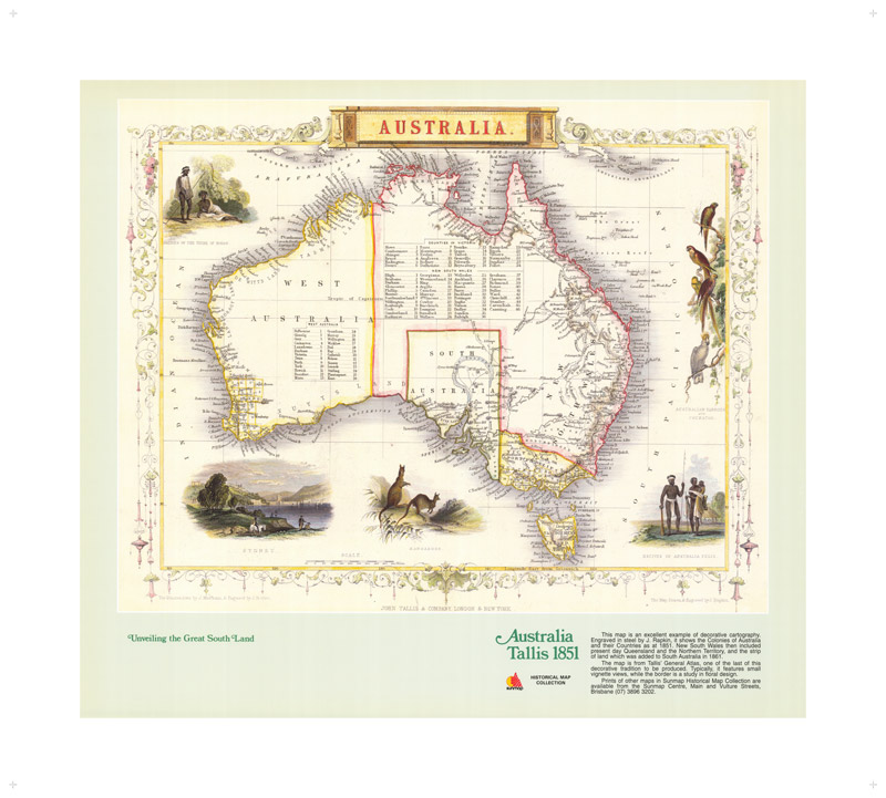
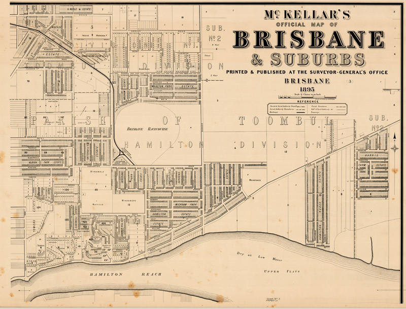
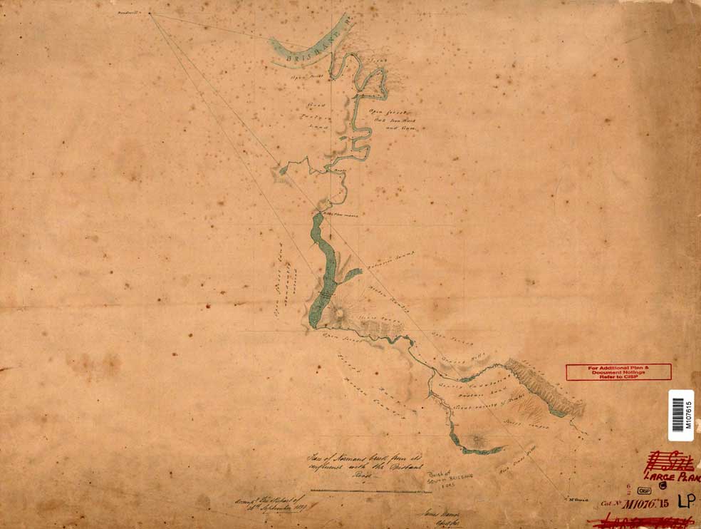
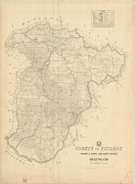
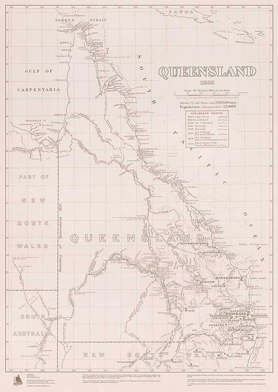
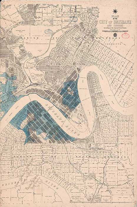
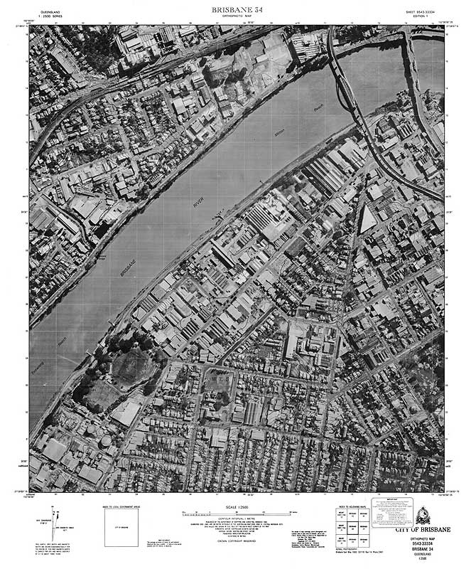
The historical maps topic is part of the Queensland Globe and provides users with the ability to search a range of historical map scans for any location in Queensland.

The steps below explain how to access historical map scans using the Queensland Globe’s historical maps topic. You can also view this information in the Historical map topic guide (PDF, 682KB).

Access historical map scans

  1. Launch Queensland Globe
  2. Select Topics
  3. Select Historical Queensland
  4. Launch Historical maps topic
  5. Select Add to Globe
  6. Select Layers - default layer shows town maps
  7. Choose layers from those displayed – Cadastral layers are shown first and then topographic layers and finally the McKellar Georeferenced map layer.
  8. Select area you wish to locate historical map scans – zoom in or use Search option.
  9. Select Toolbar
  10. Select Identify – choose one of the Identify options
  11. Select a location. Results will display in the Layers section.
  12. Select Results layer of interest.
  13. Select map of interest. Map details  display including:
    1. map name
    2. description
    3. scale
    4. date published
    5. copyright status
    6. download link for map scan and size of file
    7. preview image (select to have it display)
    8. additional metadata.
  14. The Download link and Preview Image link when selected, display in new Internet tab.

Access a different layer

  1. To go back to a different layer if there is more than one Results layer shown, use the white back arrow in the Attributes section and then in the Features section to go back to the Layers summary.
  2. A different layer can then be selected.
  3. If there is more than one result in a layer, any of the results can be selected.
  4. Use arrows in black section to move through results.

It is possible to load specific linked map layers once the Historical map topic is launched.

Layers have been linked as:

  • Cadastral early coastal maps
  • Cadastral early detailed maps
  • Cadastral parish county town and environs maps
  • Cadastral early large coverage maps
  • Cadastral standard maps
  • Contour early detailed maps
  • Contour standard maps
  • Contour and image standard maps
  1. To choose any of these links, select Add layers.
  2. Scroll through the displayed options and open Imagery and base maps.
  3. Open Historical printed maps.
  4. Because only the default town maps layer is loaded, remove all selected layers. For the series of interest, click in the empty box to select it. The map of Qld updates with the loaded bounding boxes for the maps in the selected linked map layers.

Research assistance

The Museum's Curator can assist with interpreting early records, such as land ownership and land history. Email museum@spatial-qld-support.atlassian.net to make an appointment. Lengthy investigations may incur an hourly fee.

Examples of research requests

  • Assistance in determining the history of land ownership over a block of land on Thursday Island was requested by a departmental business unit to help with a native title assessment.
  • A member of the public wished to know where a relative had owned land—we provided information from our historical cadastral map collection.
  • A researcher wanted to know the location of hotels in the Town of Gympie in the early 1870s—we provided information from our survey plans collection.
  • A member of the public sought information about a block of land in the Brisbane area owned by an ancestor—we provided information from our titles records.

Maps, photos, publications and other research resources

We hold many of the official historical maps, plans and documents of Queensland which may assist you with historical research and planning.

These resources can help answer your questions such questions as:

  • Where did my relative own land?
  • Where is my relative's block located?
  • Did the size and shape of my block change through time?

Our research resources include:

Contact us