Property reports and vegetation mapping
Vegetation categories
Vegetation management maps show the different vegetation categories on your property. On the map, the categories are shown as different colours.
Categories on the regulated vegetation management maps and PMAVs
Below is an example of a regulated vegetation management map. The table explains what the different colours on the map refer to. Note, these categories will also be present on a property map of assessable vegetation (PMAV).
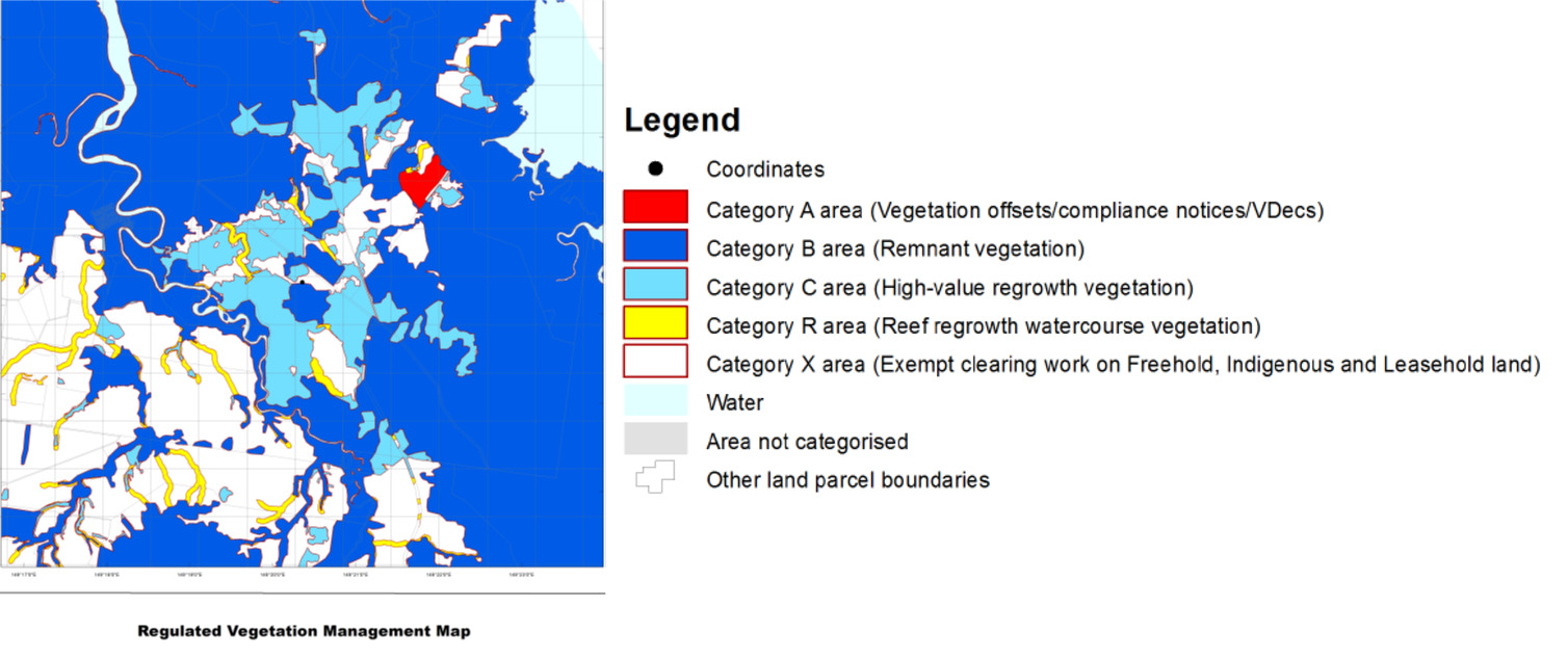
| Category | Colour on map | Areas covered |
|---|---|---|
| A | Red |
|
| B | Dark blue |
Remnant vegetation areas. This is vegetation:
|
| C | Light blue |
High-value regrowth vegetation areas. This is vegetation that is located:
Relevant clearing activities means:
|
| R | Yellow | Areas within 50m of a watercourse or drainage feature in all Great Barrier Reef catchments 354 KB) |
| X | White | Vegetation that is not mapped as a category A area, category B area, category C area or a category R area |
Categories shown on the vegetation management supporting map
Below is an example of a vegetation management supporting map. This map provides additional information such as the conservation class of the regional ecosystems, location of wetlands, essential habitat and watercourses on your property.
The table below explains what the different colours on the map refer to.
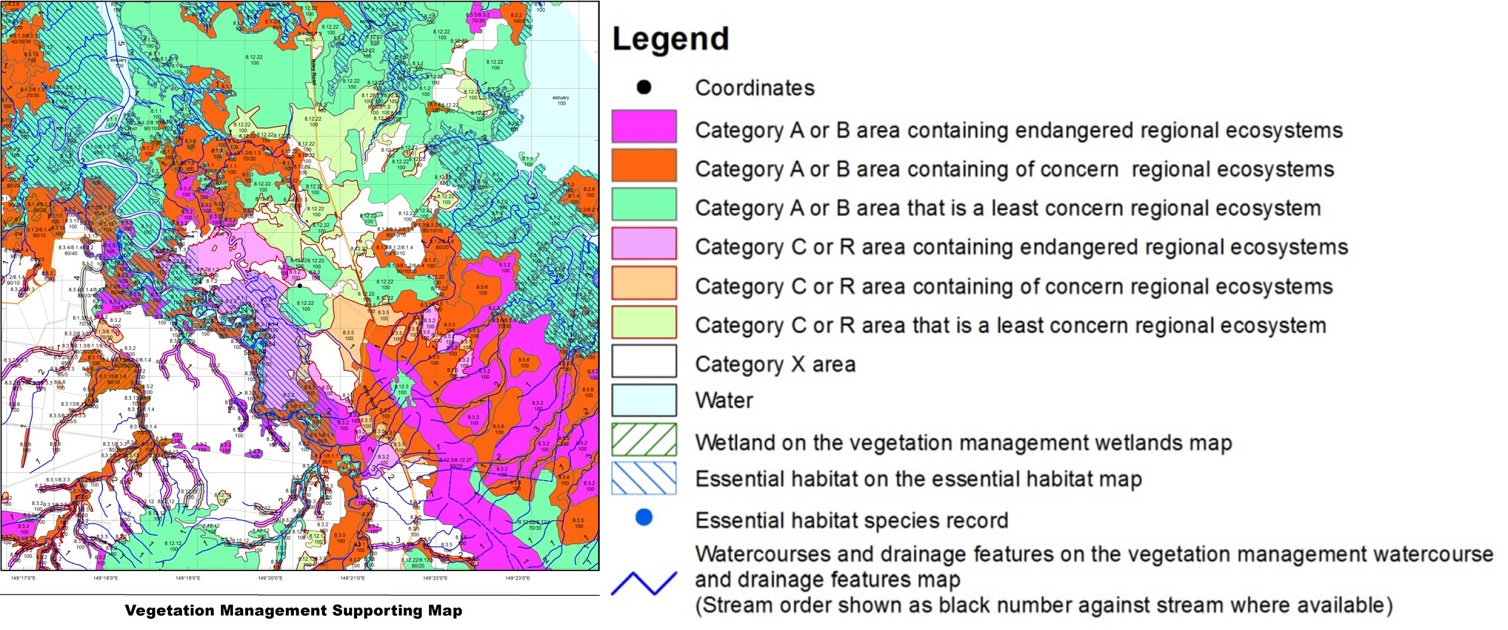
| Category | Colour on map | Description |
|---|---|---|
| A or B area containing endangered regional ecosystems | Pink |
Endangered status means:
|
| C or R area containing endangered regional ecosystems | Light pink | |
| A or B area containing of concern regional ecosystems | Orange |
Of concern class means:
|
| C or R area containing of concern regional ecosystems | Light orange | |
| A or B area that is a least concern regional ecosystem | Green | Least concern class means remnant/regrowth vegetation is over 30% of its pre-clearing extent across the bioregion, and the remnant/regrowth area is greater than 10,000 hectares |
| C or R area that is a least concern regional ecosystem | Light green | |
| Wetlands | Green hatching | Wetlands that are shown on the vegetation management wetland map |
| Essential habitat | Blue hatching | Essential habitat identifies the habitat of endangered, vulnerable or near-threatened wildlife (protected wildlife) prescribed under the Nature Conservation Act 1992. Also defined under section 20AC of the Vegetation Management Act. |
| Watercourse and drainage features | Blue line | Watercourse and drainage features shown on the vegetation management watercourse and drainage feature map |