Iama (Yam Island)
Introduction
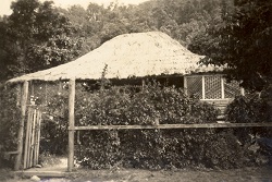
Iama (Yam Island) is situated in the central island group of Torres Strait. It is located approximately 100km northwest of Thursday Island and measures approximately 22km in size.
The Traditional Owners of Iama[1] were the same as the Islander people of Tudu (Warrior Island)[2]. The Iama/Tudu people held extensive trading links across the Torres Strait, coastal areas of Cape York and the Papuan communities of Mabaduan and Tureture[3]. The Torres Strait Islander people of Iama are of Melanesian origin, and lived in village communities following traditional patterns of hunting, fishing and agriculture for many thousands of years before contact was made with the first European visitors to the region[4].
History of Iama
European contact
In September 1792, Captain William Bligh, in charge of the British Navy ships Providence and Assistant, visited Torres Strait and mapped the main reefs and channels. On 10 September 1792, Bligh’s ships reached the central island group. Warriors from Tudu approached Bligh’s ships in their canoes and a violent exchange of arrows and musket fire occurred, resulting in deaths on both sides. After the battle, Bligh gave the name Warrior Island to Tudu and the name Turtle-Backed Island to Iama[5].
In the 1860s, beche-de-mer (sea cucumber) and pearling boats began working the reefs of Torres Strait. William Banner established a beche-de-mer station at Tudu in the 1860s. Banner was able to foster friendly relations with the local Islander people, led by the warrior Kebisu. By the 1870s, pearling stations operated by Banner and the Merriman brothers of Sydney were also based on the island. The people of Tudu, Masig and the South Pacific were employed by Banner to work on his stations[6].
Torres Strait Islanders refer to the arrival of the London Missionary Society (LMS) missionaries in July 1871 as ‘the Coming of the Light’. After visiting Erub, the LMS missionaries led by Reverend Samuel McFarlane and A W Murray travelled to Tudu. There, they enlisted the support of William Banner, who was able to provide the missionaries with advice and the services of his leading hand, a Tongan man named Tongatapu Joe. After their initial visit, the LMS missionaries appointed South Sea Islander teachers to work on Tudu[7].
In 1872, the Queensland Government sought to extend its jurisdiction and requested the support of the British Government[8]. Letters Patent were issued by the British Government in 1872, creating a new boundary for the colony which encompassed all islands within a 60 nautical mile radius of the coast of Queensland. This boundary was further extended by the Queensland Coast Islands Act 1879 (Qld)[10] to include the islands of Boigu, Erub, Mer and Saibai which lay beyond the previous 60 nautical mile limit. The new legislation enabled the Queensland Government to control and regulate bases for the beche-de-mer and pearling industries, which previously had operated outside its jurisdiction[11].
The government appointed the warrior leader Kebisu to be the ‘mamoose’ or appointed chief and representative on Tudu in the 1870s. Kebisu died around 1885, and his son Maino took over the position of mamoose[12].
Since the 1870s, the LMS missionaries had encouraged the people of Tudu to leave their island and establish a permanent settlement on Iama, which had more fertile soil and better supplies of fresh water. In 1892, the first families from Tudu, led by Maino, founded a village on the northwest side of Iama. By the mid-1890s, the majority of people from Tudu and the nearby island of Gebar, had moved to Iama. The first church on the island was built around 1902 and given the name Siloam[13].
Around 1900, the LMS missionary Reverend Walker established a philanthropic business scheme named Papuan Industries Limited (PIL). Through the scheme, Islander communities were encouraged to co-operatively rent or purchase their own pearl luggers or ‘company boats.’ The ‘company boats’ were used to harvest pearl shells and beche-de-mer, which were then sold and distributed by PIL. The people of Iama purchased their first company boats around 1905. Company boats provided Islanders with income and a sense of community pride and also improved transport and communication between the islands[14].
In November 1912, 640 acres on Iama were officially gazetted as an Aboriginal reserve by the Queensland Government. Many other Torres Strait Islands were gazetted as Aboriginal reserves at the same time[15]. By 1918, a Protector of Aboriginals had been appointed to Thursday Island and, during the 1920s and 1930s, racial legislation was strictly applied to Torres Strait Islanders, enabling the government to remove Islanders to reserves and missions across Queensland.
A worldwide influenza epidemic had also reached the Torres Strait in 1920 resulting in 96 deaths in the region. The Queensland Government provided the islands of Yam, Yorke and Coconut with food relief to help them recover from the outbreak[16].
In 1936, around 70% of the Torres Strait Islander workforce went on strike in the first organised challenge against government authority made by Torres Strait Islanders. The nine-month strike was an expression of Islanders’ anger and resentment at increasing government control of their livelihoods. The strike was a protest against government interference in wages, trade and commerce and called for the lifting of evening curfews, the removal of the permit system for inter-island travel and the recognition of the Islanders’ right to recruit their own boat crews[17].
The strike produced a number of significant reforms and innovations. Unpopular local Protector J.D McLean was removed and replaced by Cornelius O’Leary, who established a system of regular consultations with elected Islander council representatives. The new island councils were given a degree of autonomy including control over local police and courts[18].
On 23 August 1937, O’Leary convened the first Inter Islander Councillors’ Conference at Yorke Island. Representatives from 14 Torres Strait communities attended. Elap Prise, Makabi George and Simeon represented Iama at the conference. After lengthy discussions, unpopular by-laws, including the evening curfews, were cancelled and a new code of local representation was agreed upon[19]. In 1939, the Queensland Government passed the Torres Strait Islanders Act 1939, which incorporated many of the recommendations discussed at the conference. A key section of the new act officially recognised Torres Strait Islanders as a separate people from Aboriginal Australians[20].
During World War Two, the Australian Government recruited Torres Strait Islander men to serve in the armed forces. Enlisted men from Yam and other island communities formed the Torres Strait Light Infantry. The Torres Strait Light Infantry were respected as soldiers, however they only received one third of the pay given to non-Indigenous Australian servicemen. On 31 December 1943, members of the Torres Strait Light Infantry went on strike calling for equal pay and equal rights[21]. The Australian Government agreed to increase their pay to two thirds the level received by white servicemen. Full back pay was offered in compensation to the Torres Strait servicemen by the Australian Government in the 1980s[22].
After gaining its independence from Australia in 1975, Papua New Guinea asserted its right to the islands and waters of the Torres Straits. In December 1978, a treaty was signed by the Australian and Papua New Guinea governments that described the boundaries between the two countries and the use of the sea area by both parties[23]. The Torres Strait Treaty, which has operated since February 1985, contains special provision for free movement (without passports or visas) between both countries[24]. Free movement between communities applies to traditional activities such as fishing, trading and family gatherings which occur in a specifically created Protected Zone and nearby areas. The Protected Zone also assists in the preservation and protection of the land, sea, air and native plant and animal life of the Torres Strait[25].
Local government and Deed of Grant in Trust community
On 30 March 1985, the Iama community elected 3 councillors to constitute an autonomous Yam Island Council established under the Community Services (Torres Strait) Act 1984. This Act conferred local government type powers and responsibilities upon Torres Strait Islander councils for the first time. The council area, previously an Aboriginal reserve held by the Queensland Government, was transferred on 21 October 1985 to the trusteeship of the council under a Deed of Grant in Trust[27]. On 24 April 2002, the council’s name was changed from Yam Island Council to Iama Island Council.
In 2007, the Local Government Reform Commission recommended that the 15 Torres Strait Island councils be abolished and the Torres Strait Island Regional Council (TSIRC) be established in their place. In elections conducted under the Local Government Act 1993 on 15 March 2008, members of the 15 communities comprising the TSIRC local government area each voted for a local councillor and a mayor to constitute a council consisting of 15 councillors plus a mayor.
End notes
- David on behalf of the Iama People and Tudulaig v State of Queensland [2004] FCA 1576.
- M Fuary, In So Many Words: An Ethnography of Life and Identity on Yam Island, Torres Strait (PhD Thesis, James Cook University, Townsville, 1991) 72; J Singe, The Torres Strait, People and History (University of Queensland Press, St Lucia, 1979) 32.
- Fuary, above n 2, 81-83.
- Fuary, above n 2, 68-71; R E Johannes & J W MacFarlane, Traditional Fishing in the Torres Strait Islands (CSIRO, 1991) 144-155.
- Lt G Tobin, Captain Bligh’s Second Chance. An Eyewitness Account of his Return to the South Seas (University of NSW Press, Sydney, 2007) 154-156; M Flinders, A Voyage to Terra Australis, (W Bulmer and Co, London, 1814); N Sharpe, Stars of Tagai, The Torres Strait Islanders (Aboriginal Studies Press, Canberra, 1993) 20-23.
- R Ganter, The Pearl Shellers of Torres Strait (Melbourne University Press, Melbourne,1994) 19-20; Fuary, above n 2, 138-148.
- Fuary, above n 2, 156-157.
- S B Kaye, Jurisdictional Patchwork: Law of the Sea and Native Title Issues in the Torres Strait (2001) 2, Melbourne Journal of International Law, 1.
- Queensland Statutes (1963) vol 2, 712.
- See also Colonial Boundaries Act 1895 (Imp); Wacando v Commonwealth (1981) 148 CLR 1.
- S Mullins, Torres Strait: A History of Colonial Occupation and Culture Contact, 1864-1897 (Central Queensland University Press, Rockhampton, 1995) 139-161.
- Mullins, above n 11, 166.
- Fuary, above n 2, 80-81, 163; Johannes & MacFarlane, above n 4, 144.
- Ganter, above n 6, 68-75; Queensland, Annual Report of the Chief Protector of Aboriginals for 1905, 29; Sharp, above n 5, 158-161.
- Queensland, Queensland Government Gazette, vol.99, no.138 (1912) 1330.
- Queensland, Annual Report of the Chief Protector of Aboriginals for 1920 (1921) 7; Fuary, above n 2, 148.
- Sharp, above n 5, 181-186, 278; J Beckett, Torres Strait Islanders, Custom and Colonialism (Cambridge University Press, 1987) 54.
- Beckett, above n 17, 54-55.
- Sharp, above n 5, 210-214; Queensland State Archives, A/3941 Minutes of Torres Strait Councillors Conference held at Yorke Island 23-25 August 1937. This event remains important in the minds of Torres Strait Islanders. Celebrated annually, this event has become known as the ‘Anniversary of the First Torres Strait Island Councillors Conference’.
- Queensland, Annual Report Department of Native Affairs for 1939 (1940) 1; Sharp, above n 5, 214-216.
- Australian War Memorial website, Wartime Issue 12 ‘One Ilan Man’, http://www.awm.gov.au/wartime/12/article.
- Beckett, above n 17, 64-65; Australian War Memorial website, Wartime Issue 12 ‘One Ilan Man’, http://www.awm.gov.au/wartime/12/article; Fuary, above n 2, 173-177.
- For further information see the Department of Foreign Affairs and Trade website: https://www.dfat.gov.au/geo/torres-strait/Pages/the-torres-strait-treaty; Sharp, 226-227.
- Under Art. 11.
- See also Art 12.
- Further information about the Protected Zone can be found at: https://www.pzja.gov.au/.
- Queensland, Annual Report of the Department of Community Services for 1986 (1987) 3; Queensland, Annual Report of the Department of Community Services for 1987 (1988) 29.