Hope Vale
Introduction
Hope Vale is located about an hour’s drive north of Cooktown. The Thubi Warra People are recognised as the Traditional Owners of Hope Vale[1] and Guugu Yimidhirr is the main language spoken.
History of Hope Vale
European contact
The first documented contact between the Guugu Yimidhirr people and Europeans occurred in 1770 when they encountered Captain Cook and his crew who anchored in the river that Cook named after his ship the Endeavour. Cook recorded in the ship’s log that:
‘the Natives came down to the Sandy point on the North side of the Harbour, having along with them a small wooden Canoe with Outriggers, in which they seem’d to be employed striking fish, etc … Some part of their Bodys had been painted with red, and one of them had his upper lip and breast painted with Streakes of white … we met with 5 of the Natives, and although we had not seen any of them before, they came to us without showing any signs of fear. 2 of these wore Necklaces made of Shells, which they seem’d to Value, as they would not part with them’[2].
Years later, in 1819, Royal Navy Captain Phillip Parker King surveyed the east coast of Australia. While anchored in the Endeavour River, King recorded that:
‘twelve natives boldly visited our watering party, and followed them to the tent, where they remained some time watching our movements with great attention. They repeatedly made signs for hatchets, but evinced great aversion to a clasp-knife, although its use was shown to them. Mr. Bedwell obtained a shield from one of them, of a crescented shape, and painted with black stripes; it was made from the wood of the Erythrina indica or coral tree, which grows abundantly near the anchorage’[3].
European settlement of the area around Cooktown began in 1872, when William Hann’s exploration party discovered gold on the Palmer River, southwest of Cooktown. After hearing of the discovery, James Mulligan led an expedition to the Palmer River in 1873. Mulligan reported that the sandbars of the river glittered with gold, which initiated a huge gold rush to the district[4]. By late 1873, the first government officials and prospectors came ashore at the Endeavour River accompanied by a detachment of Native Police[5].
In 1874 Cooktown was established. Within 4 months, Cooktown and the Palmer River goldfield had a population of about 3,000 people, many of whom were Chinese immigrants. By 1880, the population of Cooktown had grown to about 7,000[6].
Conflict between the Europeans and the local Aboriginal people began almost immediately. In October 1873, 93 miners (led by Goldfields Commissioner Howard St George and Engineer A.C. MacMillan), set out from the Endeavour River to blaze a track to the Palmer River. There were several skirmishes along the way, culminating in a pitched battle between about 150 Aboriginal warriors and the expedition members at their camp near the Normanby River. The site of this encounter was subsequently named ‘Battle Camp’. A contemporary newspaper published the following account of the battle from one of the expedition members:
‘Blacks surprised us at daybreak, about 150, all were armed; got close to the camp before anyone heard them; great consternation; shot several; they ran into large waterholes for shelter, where they were shot’[7].
Pastoral stations were established in the Laura area from 1874 and the Native Police established a camp at Laura in 1875. A further detachment under the command of Sub-Inspector O’Connor arrived in January 1876[8]. However, Aboriginal people continued to resist the invasion of their lands by the miners and pastoralists. Frontier violence in the region was a frequent occurrence during the 1870s, resulting in hundreds of casualties[9]. The Native Police maintained an active presence in the region for over 30 years[10].
In the 1890s, mining activity in the region slowly declined. Aboriginal men began to be employed as stockmen and workers on the surrounding pastoral stations and Aboriginal fringe camps were established on the outskirts of towns[11]. At first, Aboriginal people had been allowed into the towns to perform odd jobs. However, by 1885, they were excluded after dark[12].
John Davis, the Mayor of Cooktown at the time, suggested that a reserve be established at the North Shore for local Aboriginal people. He thought that putting the local groups on to a reserve would keep them from ‘any unnecessary intermingling’ with the European residents of Cooktown and provide a ready labour force for the beche-de-mer fishing industry[13].
In 1885, Lutheran missionary Johann Flierl was travelling to New Guinea when he was unexpectedly delayed in Cooktown. While there, he negotiated with the Queensland Government to establish a mission close to Cooktown at Cape Bedford, on the land which had previously been gazetted as an Aboriginal reserve in 1881[14]. At the same time he also negotiated the establishment of a mission at the Bloomfield River. The original mission on the beach at Cape Bedford was known as Elim. Flierl left the mission in 1887 and was replaced by George Schwartz, who remained at the mission for more than 50 years. He was called ‘Muni’ by Aboriginal people at Hope Vale[15].
The mission population was initially comprised of what the Northern Protector Walter Roth referred to as, the ‘waifs and strays’ of Cooktown[16]. In the intervening years the mission population diversified to include people from the many different family groups that comprise the Guugu Yimidhirr people and others from further afield[17].
The Lutheran missionaries believed that the best way to convey the ‘Word of God’ was through the use of local languages. As a result, unlike most other missions, the children at Cape Bedford were taught in the local Guugu-Yimidhirr language[18].
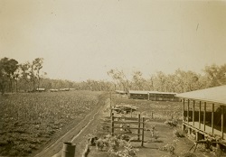
Schwartz established a second site for the mission in December 1887, which he called Hope Valley. For 13 years the mission operated out of both locations. In 1900, Swartz closed down Elim and consolidated the mission at Hope Valley. In March 1899 and again in 1907, the mission suffered damage from cyclones. In 1902 the Mari Yamba Lutheran mission near Proserpine was closed and its residents transferred to Hope Valley. In 1909 the reserve area was extended to include land along the McIvor River. Schwartz established the Wayarego outstation on the McIvor River about 1911[19].
In 1914, the mission was moved to Spring Hill at the southern end of the reserve area. During the 1920s, Point Lookout was used as a dugong fishing outstation and the old Elim site was used as a beche-de-mer station. Over the years the reserve area was amended several times and by 1934 the size of the reserve was 225,300 acres and included Mt Webb[20].
In May 1942, George Schwartz was arrested by Military Police and sent to an internment camp near Brisbane. He was then released but not allowed to leave the Brisbane district. The 254 residents of Cape Bedford were evacuated from the mission, with the majority removed to Woorabinda. The mission was subsequently taken over by the Australian and American armed forces and the Civil Construction Corps. Sixty of the Cape Bedford people died while at Woorabinda.
After the war, the Cape Bedford residents were assisted by the Lutheran Church and Joh Bjelke-Petersen MLA in their efforts to re-establish the mission at Cape Bedford. A work party of residents returned to the mission in 1949, to find it had been severely damaged. A new mission called Hope Vale was constructed on the Endeavour River 25km from the old site on land previously owned by the Cooktown Plantations Company. The rest of the residents then made their way back to the new mission[21]. The new mission site was finally gazetted as an Aboriginal reserve in September 1952[22].
In 1955, the Hope Vale Mission Board made a complaint about the encroachment of Starcke Graziers onto land belonging to the mission. Eventually the area occupied by the Starcke Graziers was excised from the reserved land but, in return, Starcke land was surrendered to the mission[23].
Local government and Deed of Grant in Trust community
On 30 March 1985, the Hope Vale community elected 5 councillors to constitute an autonomous Hope Vale Aboriginal Council, established under the Community Services (Aborigines) Act 1984. The council area, previously an Aboriginal reserve held by the Queensland Government, was transferred on 16 July 1986 to the trusteeship of the council under a Deed of Grant in Trust. See also the Hopevale Congress Aboriginal Corporation.
End notes
- Deeral v Charlie (Unreported, FCA, 8 December 1997, Beaumont J).
- Captain W.J.L Wharton (ed.), Captain Cook's Journal during his first voyage round the world made in H.M. Bark “Endeavour” 1768-71 (1893).
- Captain Phillip Parker King, Narrative of a Survey of the Intertropical and Western Coasts of Australia Performed between the years 1818 and 1822 (John Murray, London, 1827) vol.1, ch.6.
- G Pike, Queen of the North: A Pictorial History of Cooktown and Cape York Peninsula (G. Pike, Mareeba, 1979) 22-23.
- Howard Pohlner, Gangurru (Hope Vale Mission Board, Milton, 1986).
- Above n 4.
- COL/A194, 74/701 Inquiry into the deaths of Aborigines at the Normanby River; Author unknown, ‘The Palmer’, Brisbane Telegraph, 23 January 1874.
- Author unknown, ‘Cooktown’, Brisbane Courier, 10 January 1876, 3.
- Author unknown, ‘The New Goldfields’, Brisbane Courier, 27 March 1876, 3.
- J Richards, The Secret War: a history of Queensland’s Native Police (University of Queensland Press, St Lucia, 2008) 108.
- F Mackeith (ed.), Letters from Laura (James Cook University, Townsville, 1987) 1, 10.
- R Ganter, Cape Bedford Mission (Hope Vale) (1886-1942) (date unknown) http://missionaries.griffith.edu.au/qld-mission/cape-bedford-mission-hope-vale-1886-1942 at 18 December 2012.
- COL/A317, 81/3205.
- Queensland, Queensland Government Gazette, 1881, 390, 1006.
- Above n 12.
- COL/139, Letter from Walter Roth to Commissioner of Police, 6 June 1898.
- Department of Aboriginal and Torres Strait Islander Partnerships, Community and Personal Histories Removals Database (access restricted).
- Above n 12.
- Above n 12.
- Above n 12.
- Above n 12; A/58886, 42/4050, evacuation of Cape Bedford mission.
- Queensland, Queensland Government Gazette, 13 September 1952, 78-79.
- A/58890, 60/6497.