Hinchinbrook region
Introduction
The Hinchinbrook region covers the Cassowary Coast and Hinchinbrook shires.
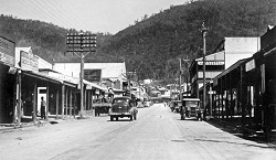
The Cassowary Coast Shire is located in far north Queensland, extending from Garradunga in the north to Cardwell in the south and the East Palmerston district in the west. It includes the centres of Innisfail, Tully, Cardwell and Mission Beach. The Hinchinbrook Shire is located about 110km northwest of Townsville and is named after Hinchinbrook Island, which is separated from the mainland by the Hinchinbrook Channel. The main administrative centre for this shire is Ingham.
The 2 shires are home to several different Indigenous groups. The Girringun Aboriginal Corporation, based in Cardwell, represents the interests of Traditional Owners[1] from 9 tribal groups of the area; the Bandjin, Djiru, Girramay, Gugu Badhun, Gulngay, Jirrbal, Nywaigi, Warrgamay and Warungnu.
Traditional boundaries for the groups extend from Maria Creek north of Tully, south along the coastline as far as Rollingstone Creek. These lands encompass country to the west which surrounds Greenvale, and Northwest, following the Tully River to Ravenshoe. Hinchinbrook, Goold, Brooke, Family and Dunk Islands and surrounding waters are also included in this area[2].
History of the area
European contact
In 1770, Captain James Cook, in charge of HM Endeavour, was the first European explorer to visit the area. Cook observed groups of Aboriginal people living together on the Family Islands but did not land or attempt to make contact with them[3]. Seafarers who followed in the path of Cook included Phillip Parker King, in charge of the Mermaid in 1821 and Francis Blackwood in command of HMS Fly in 1843. King and Blackwood made more detailed surveys of the coastline and established peaceful contact with the Aboriginal people of the Cardwell area and offshore islands[4].
In November 1848, an exploration party led by Edmund Kennedy landed to the north of the present day location of Cardwell. Kennedy’s aim was to travel northwards along the coast to the tip of Cape York but his journey was immediately frustrated by the thick rainforest, swamps and rivers of the area. After 2 months, Kennedy’s party eventually found a pathway through the mountains to the west of Cardwell and Tully and blazed an inland trail to Cape York. Kennedy’s expedition ultimately ended in tragedy; but during his time in the Cardwell area, he maintained friendly relations with the local Aboriginal people[5].
The German explorer Ludwig Leichhardt travelled through the upper reaches of the Burdekin River and the Valley of Lagoons west of Ingham in 1845, during his expedition from Jimbour to Port Essington[6]. Leichhardt’s reports of good land at the Valley of Lagoons inspired a private expedition led by George Elphinstone Dalrymple to travel overland from Rockhampton to the area in 1859.
The Queensland Government officially opened the Kennedy district of far north Queensland for leasing in January 1861. George Dalrymple and 3 business partners took up a pastoral run in the Valley of Lagoons in 1863. With the backing of the Queensland Government, George Dalrymple established a settlement on Rockingham Bay in 1864, to serve as a port for the pastoral stations of the Kennedy district. Dalrymple led a small party from Rockingham Bay inland to the Valley of Lagoons and then returned, hacking out a dray route to the coast[7]. The settlement at Rockingham Bay was originally known as Port Hinchinbrook, but was renamed Cardwell by Governor Bowen[8].
Pastoral runs were quickly taken up across the Kennedy district, but the pace of settlement in the Cardwell area was slow. Cardwell was quickly superseded as a port by Townsville. Sugar plantations were established to the south in the Herbert River in the 1870s. The Tully River, north of Cardwell, was opened up to sugar production and Chinese banana farms in the 1880s. Rainforest in the Ravenshoe area was harvested by loggers for prized timbers such as red cedar[9].
Aboriginal people resisted the invasion of their lands by the pastoralists and settlers. Frontier violence occurred across the Cardwell district and surrounding areas from the mid-1860s through to the early 1880s[10].
The use of mounted Native Police was instrumental in crushing the resistance of local Aboriginal people. A Native Police camp was established at Cardwell in 1864 and another on the Herbert River in 1870[11]. In 1874, the missionary Reverend E. Fuller travelled to Cardwell with the ambition of establishing a mission for Aboriginal people on Hinchinbrook Island[12]. Before his arrival, Native Police had decimated the Aboriginal population of the Island. After three weeks searching, Rev. Fuller was unable to the find a single Aboriginal person living on Hinchinbrook Island[13].
The Queensland Government set aside reserve areas for the use of Aboriginal people in the county of Cardwell in 1878, on the Tully River in 1886, and at Halifax Bay, near Saltwater Creek, in 1889. However, these parcels of land were not used as they were intended and eventually, the government reserved the land for other uses[14].
In 1897, the Queensland Government passed the Aboriginals Protection and Restriction of the Sale of Opium Act 1897. Under this Act and subsequent Aboriginal Protection Acts, the government appointed local protectors to districts across Queensland including Cardwell, Ingham, Ravenshoe and Tully. Protectors exercised control over Aboriginal labour and savings accounts and were authorised to remove Aboriginal people to reserves and missions across Queensland[15].
In 1913, the Queensland Government authorised the establishment of a new Aboriginal reserve at Hull River, located to the east of Tully. An area of 2900 acres was gazetted for the reserve, and John Kenny was appointed superintendent of the reserve in September 1914[16]. Between the years 1914 and 1918, 465 Aboriginal people were removed to the Hull River reserve, with large numbers taken from the Cardwell, Clump Point, Murray and Tully River areas[17]. Under Kenny’s leadership, sections of land were cleared by Aboriginal workers and housing for administrative staff and storage sheds erected. Boats were purchased for fishing and areas cultivated for fruit and vegetable production[18].
On 10 March 1918, a cyclone hit the reserve, killing Superintendent Kenny, his daughter and 12 Aboriginal residents. All buildings and crops at the reserve were completely destroyed. The government transferred the surviving residents to Palm Island[19]. Aboriginal people from the Cardwell, Ingham, Ravenshoe and Tully areas continued to be removed to reserves, including Palm Island, until the end of the 1950s[20].
Members of the Australian Inland Mission began work among the Jirrbal people of the Ravenshoe district in the 1920s and a small mission settlement was built near the Little Millstream Falls. Missionaries left around 1934, but the settlement remained an important campsite and a significant area for the Jirrbal people. In 1951, 15 acres of land was gazetted at Ravenshoe by the Queensland Government, with the intention of providing better conditions for Aboriginal people living at the old mission camp[21].
In 1953, the government destroyed the huts at the old mission camp at Little Millstream Falls. The Department of Native Affairs was then pressured to complete construction of housing on the new reserve at Ravenshoe by the Ravenshoe and District Progress Association, and by Ravenshoe residents who were unhappy with the way local Aboriginal people had been treated. Some accommodation was erected on the reserve in the 1950s. Local Aboriginal people, however, regarded the reserve as a wet, unhealthy place and government efforts to resettle them on the reserve proved unsuccessful[22].
During the 1970s, a number of sugar cane farms in the Murray Upper area were purchased to allow Aboriginal families to return to the district. The Jumbun Aboriginal Community was established on a 244 hectare freehold property. In 2008, Jumbun had a population of around 130 people and around 26 houses, a store, health centre, keeping place and community hall.
End notes
- Hart on behalf of the Djiru People 2 v State of Queensland [2011] FCA 1056; Hart on behalf of the Djiru People 3 v State of Queensland [2011] FCA 1056.
- Girringun Aboriginal Corporation, About Us (date unknown) http://www.girringun.com.au at 23 January 2013.
- D Jones, Cardwell Shire Story (Jacaranda Press, Brisbane, 1961) 2-3.
- Ibid, 9-14.
- E Beale, Kennedy of Cape York (Rigby, Adelaide,1970) 151-182; Australian Dictionary of Biography, Kennedy, Edmund Besley Court (1818-1848) (2013) at http://adb.anu.edu.au/biography/kennedy-edmund-besley-court-2297 at 23 January 2013.
- Leichhardt, Journal of an Overland Expedition in Australia, from Moreton Bay to Port Essington (1980) http://ebooks.adelaide.edu.au/l/leichhardt/ludwig/l52j/ at 24 May 2013.
- Australian Dictionary of Biography, Ernest George, Dalrymple (1820--1844) (2013) http://adb.anu.edu.au/biography/dalrymple-ernest-george-1950 at 23 January 2013; Jones, above n 3, 61-83.
- Jones, above n 3, 84.
- Jones, above n 3, 144-156, 223-236, 288-291.
- Jones, above n 3, 91, 157-163; R.M.W. Dixon, The Dyirbal Language of North Queensland (1972) 34-35.
- Jonathan Richards, A Question of Necessity: The Native Police in Queensland (PhD Thesis, School of Arts, Media and Culture, Griffith University, 2005).
- Author unknown, ‘Mission to the Aborigines’, The Queenslander, 14 February 1874, 3.
- Author unknown, ‘The Abandonment of Gilberton’, The Queenslander, 4 April 1874, 10; R. Kidd, The Way We Civilise (2005) 14.
- Queensland, Queensland Government Gazette, 16 January 1886, 158; Queensland, Queensland Government Gazette, 8 June 1889, 419; Queensland Government Gazette, 21 January 1911, p.552.
- R Kidd The Way We Civilise (University of Queensland Press, Brisbane 2005)
- Queensland, Annual Report of the Chief Protector of Aboriginals 1913, 4; Queensland, Queensland Government Gazette, 6 September 1913, 555; Queensland, Annual Report of the Chief Protector of Aboriginals 1914, 16.
- Queensland, Department of Aboriginal and Torres Strait Islander Affairs, Community & Personal Histories Removals Database.
- Queensland, Annual Report of the Chief Protector of Aboriginals 1915, 13-14; Queensland, Annual Report of the Chief Protector of Aboriginals 1916, 10-11.
- Queensland, Annual Report of the Chief Protector of Aboriginals 1918, 9; Author unknown, ‘Hull River Settlement’, Brisbane Courier, 15 March 1918, 6; Author unknown, ‘Northern Aborigines Settlement’, Brisbane Courier, 7 June 1918, 6.
- Queensland, Department of Aboriginal and Torres Strait Islander Affairs, Community & Personal Histories Removals Database (restricted access).
- A Smith (ed.), Red Gold to Ravenshoe (Ravenshoe Historical Society, Ravenshoe, 2001) 5; Queensland, Queensland Government Gazette, 2 June 1951, 569.
- Queensland State Archives, Director of Native Affairs Office, Series SRS 505/1, Correspondence Files, Item 7C/14, Protectorates Reserves, Ravenshoe Reserve; Queensland Art Gallery, Ravenshoe (2003) http://www.visualarts.qld.gov.au/storyplace/place_ravenshoe.htm at 23 January 2013.