Fire scar mapping explained
Large areas of Queensland’s landscape burn every year. The location and timing of fires can have long term effects that influence vegetation structure, biodiversity conservation, land condition, water and air quality, and greenhouse gas emissions. By understanding where and when fires have occurred, we can improve future fire planning and management.
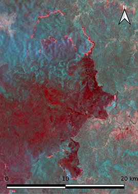
Remote Sensing Scientists map fire history by detecting ‘fire scars’, the visibly blackened land surface left after a fire has burned through vegetation. This detailed, state-wide fire scar mapping can be used for:
- managing natural resources
- assessing fire hazard and risk
- understanding the impacts of fire on grazing production
- monitoring and reporting ecological impacts of fire
- assessing variability in fire regimes over time
- developing strategic and operational fire planning and management
- informing carbon abatement schemes and greenhouse emissions.
Detecting fire scars
Fires and fire scars are often visible from space, using certain types of satellite imagery. However, it can be a challenge to accurately map fire history across the diverse landscapes of Queensland. In tropical and sub-tropical regions, blackened areas may disappear in a few weeks as new vegetation growth emerges. In arid and temperate zones, vegetation takes longer to grow and fire scars may persist for months or even years. Some satellites can detect actively burning areas but may not detect the full burnt area due to cloud or delays in satellite imagery acquisition.
Remote Sensing Sciences, in partnership with the Joint Remote Sensing Research Program, has developed methods to map historical and recent fire scars using Landsat and Sentinel-2 satellite imagery. These fire scar mapping products capture the detailed fire history across Queensland from 1986 onwards.
Contact us
For more information on fire scar mapping, contact our Principal Scientist, Deanna Van Den Berg, deanna.vandenberg@des.qld.gov.au.