Goondicum mine remediation project
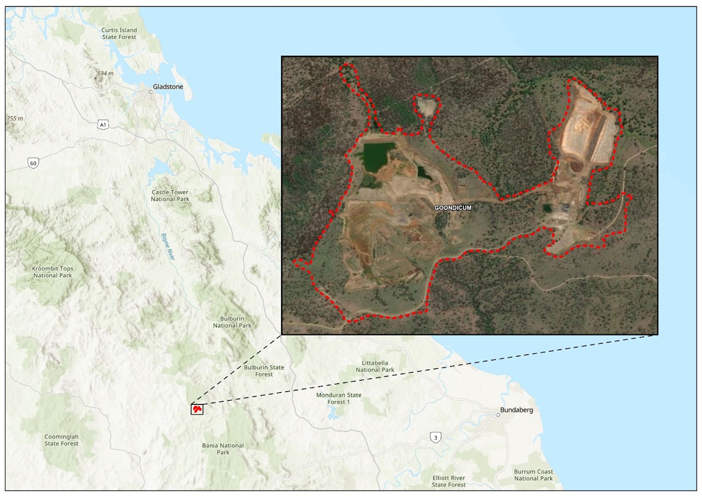
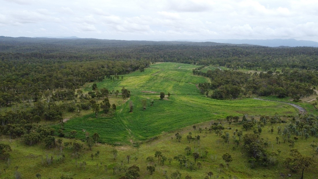
The Goondicum mine was a mineral sands operation located in the North Burnett region of Queensland that produced ilmenite, feldspar, apatite and magnetite. The site is approximately 30km east of Monto and 160km south-west of Gladstone, within the headwaters of the Burnett River. The mine is also located within the Goondicum Station which is used for active cattle grazing.
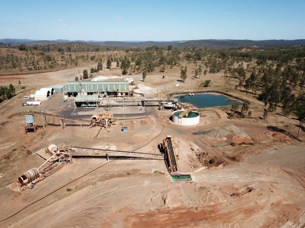
In September 2019, the Goondicum mine was placed into voluntary administration, then in October 2020 the former mining leases and environmental authorities were disclaimed, resulting in the site becoming an abandoned mine. When it was abandoned, the Goondicum mine included 2 open-cut mining pits, 3 tailings storage cells, and remnant processing plant infrastructure.
Our remediation works at the site were completed in 2025.
- View a glossary of mining terms used on this page.
Project snapshot
Region: Central Queensland
Location: 30km east of Monto, Latitude -24.847000, Longitude 151.404400
Commodity: Ilmenite and apatite
Mining type: Open cut
Date of abandonment: October 2020
Status: Remediated
Native title interest: N/A
Public land registers: Not listed
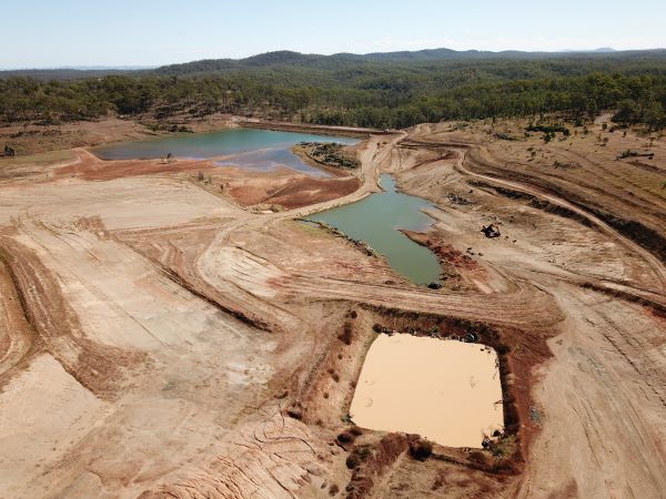
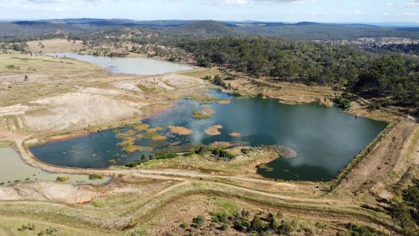
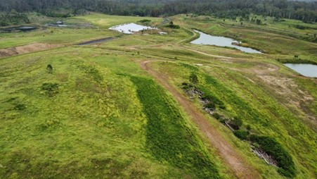
Photo gallery
Key risks
Environmental risks associated with long-term containment of tailings including integrity of embankments and drains during extreme rainfall events.
Completed works
- Care and maintenance operations, including active water management activities and preventing unauthorised site entry.
- Make-safe works including removal of chemicals, stabilisation of drainage infrastructure, and general site clean-up.
- Investigations and remediation planning, including water balance and regulated structure assessments, assessment of final landform options, environmental assessments, sampling and engineering designs.
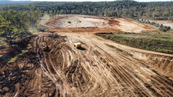
- Remediation of the Eastern Domain, including:
- decommissioning a former process water dam and small tailings cell
- reshaping the former shallow mining pits to create a stable and free-draining landform
- constructing rock-lined stormwater drains to control erosion
- soil improvements and seeding to allow grazing pasture to establish.
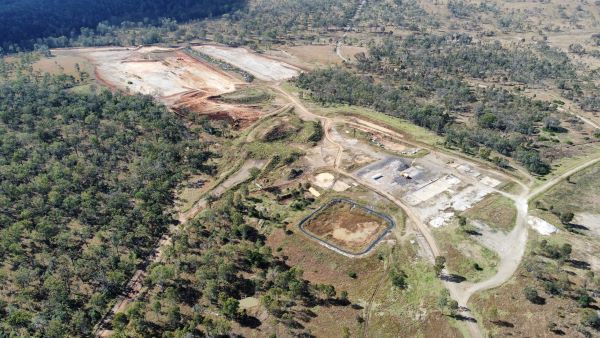
- Remediation of the Western Domain, including:
- dewatering of the tailings dams
- excavation of new closure spillways rated for extreme weather events
- reprofiling and stabilisation of the tailings dam embankments and impoundment areas to create free-draining landforms
- retention of some wetlands within the landforms where able
- revegetation activities to allow grazing pasture to establish.
- Remediation of the associated offsite Dakiel processing area, including removal of stored chemicals and minor landscaping and drainage works.