Gondwana—Threat management
Protecting habitats from future bushfire
The unusual scale of the 2019–20 bushfire season was a result of dangerous fire conditions with above average daytime temperatures, very low relative humidity and gusty winds. It followed a prolonged and severe drought in South East Queensland. The national measure of bushfire conditions (the McArthur Forest Fire Danger Index), showed that for the very high index value (>25), the Gondwana World Heritage Area experienced more than 50 days at this level in 2019. By comparison, the previous maximum number of days at this level was 30 days recorded in 1994 (based on historic records dating back to 1950).
The impacts of the 2019–20 fires accelerated a review of the strategic approach to fire management on the protected areas across the Gondwana World Heritage Area. In 2020, priority on-ground actions were implemented to improve capacity for an emergency response to a future bushfire and reduce the risk to fire-sensitive ecosystems and/or refugia for threatened species to support their post-fire recovery. The activities highlighted below were funded through this project and complement other fire management activities underway across the Gondwana World Heritage Area.
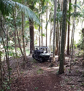
In the northern fire-impacted section of Lamington National Park, a 1 kilometre section of the Old Cedar Road was widened from a track to enable access for side-by-side vehicles to carry water and reduce carriage of a bushfire through the understorey.
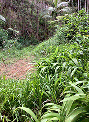
At Mt Barney National Park, a 4.7 kilometre critical fireline was established by widening the Linn Track along the Queensland–New South Wales border. This will improve access for emergency vehicles and increase the capacity of park managers to fight a bushfire and protect threatened species populations.
In the northern section of Main Range National Park, a 2.4 kilometre section of the existing Banshee fireline was cleared of hazardous vegetation to reduce the risk of fire to unburnt refugia in the Gommburra section of the park.
Controlling invasive weeds
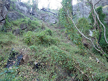
The loss of native vegetation cover from the fires increase the ability of weeds to invade new sites or quickly dominate the habitat, given their capacity to grow and reproduce in a short timeframe and to adapt to a wide range of environmental conditions. In particular, high biomass exotic grasses pose a serious risk to the recovery of burnt plant communities struggling to regenerate by competing with native plants for available water and nutrients. These grasses also create a new fire hazard which can elevate the severity of any subsequent fire, further reducing the capacity of the habitat to recover. Post-fire incursion of other exotic species such as croftonweed, lantana, devil’s fig or tobacco bush also reduce the germination of native seeds or the growth of seedlings by rapidly using critical environmental resources, including sunlight. Aggressive introduced vines such as madiera vine, cat’s claw and moth vine can soon smother canopies and dominate the seed bank. In riparian zones, other species such as the deceptive palm grass can swiftly establish a dense root mass with rhizomes that impede the recovery of native palms and other local species.
The work outlined below was specific to this project and was in addition to a wide range of other weed control activities undertaken by QPWS after the fires.
In Lamington National Park, weeds such lantana, mistflower and croftonweed were treated along the Caves Circuit to reduce ecological impacts, the risk of future fires and support native regeneration over an almost 8 hectare section of the park.
At Mt Barney National Park, a wide range of invasive plants were controlled over a 27 hectare section of the park, including vasey’s grass, groundsel, ragweed and fireweed. Woody shrubs or small trees such as lantana, devil’s fig and tobacco bush were also targeted over an estimated 4.8 hectare area. In Cronan Creek, palm grass and other priority weeds were carefully treated along a 7.5 kilometre section.
Across multiple areas of Main Range National Park, including Goomburra, Spicers Gap, Emuvale and areas adjacent to the Cunninghams Highway, a wide range of priority weeds were targeted, such as cat’s claw (over 20 hectares), lantana (30 hectares), moth vine (almost 10 hectares) and Chinese elm (over 18 hectares).
Controlling pest animals
The control of pest animals on protected areas continued after the 2019 fires with an additional focus on species that presented the greatest threat to the recovery of threatened plants and animals.
Feral pigs
Pigs were targeted for post-fire control in Mt Barney and Main National Parks due the wide range of impacts they can have on wildlife and their habitats. These impacts include turning extensive areas of the ground layer to consume seeds, fruits, tubers, seedlings and small animals whilst potentially introducing disease and weeds to regenerating ecosystems.
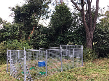
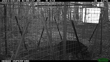
In the Burnett Creek section of Mt Barney National Park, a post-fire increase in pig activity was addressed to protect the recovery of priority threatened frog species in this creek system. New pig traps with remote satellite monitoring devices were deployed, with six pigs trapped and trapping efforts ongoing.
In Main Range National Park, six pig traps were deployed across two sections of the park and baits deployed at a third section, with the threat from at least 34 pigs now removed from the park, and control efforts continuing.
Wandering stock
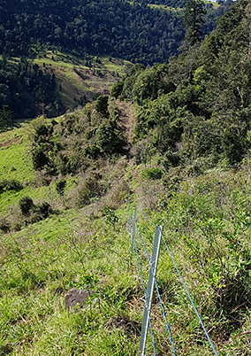
The risk of cattle moving onto park from neighbouring properties can increase after intense bushfires, due direct damage to existing fencing and the attractiveness of fresh vegetative growth to grazing stock. The impacts of stock trampling, consuming regenerating native plants and introducing weed seeds can significantly impede the post-fire natural regeneration processes. The replacement or installation of fences to exclude stock from the park was critical in some areas to support the recovery of priority threatened species.
In Lamington National Park, a 1.3 km section of fencing that was damaged in the 2019 bushfires was replaced to exclude catttle from the fire-impacted lowland sub-tropical rainforests. It required working in steep and difficult terrain and carrying materials in by hand. The results complemented other concurrent fencing efforts to double the length of exclusion fence in the Illinbah section of the park.
Stock fencing was also constructed in the Emuvale section of Main Range National Park with an existing fence extended by 500 metres and stop cattle from accessing a core area of unburnt habitat, which was serving as a critical refuge for threatened species in an extensively burnt landscape.
Feral cats and foxes
Foxes and feral cats readily seek out prey in post-fire conditions when protective vegetation cover is sparse and wildlife is more mobile seeking scarce food supplies or unburnt habitats. This presents a significant threat to the recovery of wildlife populations (such as the threatened Brush-tailed Rock-wallaby), with juveniles especially being at greater risk of predation.
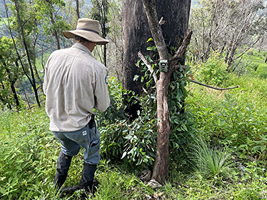
At Lamington National Park, 14 camera traps were set on two different occasions to monitor for the presence of feral cats or foxes in the Illinbah, Gwongoorool and West Canungra Creek sections of the park. Only 1 fox and 1 cat were detected.
Information regarding the presence and location of pest animals was also captured during the ecological surveys by utilising the many camera traps set up to specifically target priority threatened species. By the end of the project, these results provided a richer insight into the threats to recovering wildlife populations. Across Lamington, Mt Barney and Main Range National Parks, feral cats were detected at 32 different camera sites, foxes at 7 sites, feral deer at 4 sites and pigs at 3 sites. This information is now guiding the ongoing pest animal control efforts through the second phase of the program in 2021–22.