Water monitoring and data
We monitor the quantity and quality of surface freshwater and groundwater systems across Queensland, and the water quality of Queensland coastal catchments. This supports natural resource management initiatives and water planning.
Accessing monitoring information
Access the latest water quality and quantity information from our surface water and groundwater sites across Queensland.
You can access:
- the latest stream height and flow values from our river and stream monitoring sites throughout Queensland*
- groundwater levels from our monitoring bores equipped with data loggers*
- historic streamflow data from decommissioned river and stream monitoring sites
- a list of our water monitoring network sites.
* Please note that latest instantaneous and latest daily values will be unverified data
This service operates for water assessment and management purposes. For weather or flood warnings, please refer to the Bureau of Meteorology.
Pesticide Reporting Portal
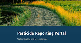
Access the latest information about pesticide concentrations in Queensland waterways using the Pesticide Reporting Portal.
The portal provides access to the results from water samples collected by more than 30 regional partner organisations including First Nations people, agricultural industries, natural resource management bodies, councils and landholders.
The data include pesticide concentrations in association with guidelines for three environmental values—aquatic ecosystems, irrigation water and drinking water.
The portal designed for organisations and individuals with an interest in the water quality of Queensland’s waterways and can support their decision making and management approaches.
To request data used in the Pesticide Reporting Portal email wqi@qld.gov.au.
The pesticide concentration data underpin, but are distinct from, the Pesticide Risk Metric data reported through the Paddock to Reef Integrated Monitoring, Modelling and Reporting Program and Reef Water Quality Report Cards, all of which can be accessed through the Reef 2050 Water Quality Improvement Plan website.
Wetlands information
Access a range of wetlands data on water quality, quantity and ecosystem monitoring:
Assessment programs
You can view reports relating to the Q-Catchments program (formerly the Stream and Estuary Assessment Program) and the Environmental Flows Assessment Program in the library catalogue.
Harmful algae
Harmful algal blooms are common seasonal events in both fresh and coastal marine waters. Find out about blue-green algae and the dangers to humans and stock.
Coastal catchments
Scientific data is available for the following subject areas:
- Water quality monitoring across Queensland coastal catchments.
- Nutrients, total suspended solids and pesticide and loads.
The Great Barrier Reef Catchment Loads Monitoring Program report the annual monitored mass loads of total suspended solids and nutrients, and a pesticide risk metric for priority catchments.
Further information about this program is available at reefplan.gov.au and water quality monitoring or you may contact us via email wqi@qld.gov.au to request data. There may be a cost involved, depending on the data requested.
Some datasets are available through Queensland Government open data.
Related information
- For the latest information about stream and river heights for flood warning purposes, please refer to the Bureau of Meteorology.
- The Queensland Integrated Waterways Monitoring Framework is a comprehensive model for waterways monitoring in the state.
- Read how monitoring data feeds into the water planning process.