Review of the Zoning Plan for Great Sandy Marine Park
The Great Sandy Marine Park is a multiple use park established in 2006 to protect its significant natural and cultural values while providing opportunities for a range of different uses.
The Queensland Government undertook a review of the zoning plan for the Great Sandy Marine Park, which was completed in July 2023.
The outcomes of the review resulted in a new zoning plan for the marine park with changes including:
- an increase in the proportion of green zones to represent 12.8% of the area of the marine park, contributing to a total of 28.6% of the marine park in highly protected zones (green and yellow zones)
- removal of commercial large mesh gill nets and ring nets (operating under N1 and N2 fishery symbols) from the Conservation Park zones within Baffle Creek, Elliott River, Burrum River system, the Great Sandy Strait and Tin Can Inlet
- measures to increase protection of threatened species, including shorebirds, turtles, dugongs and grey nurse sharks
- measures to protect cultural and amenity values
- zone changes to facilitate local government responses to increased coastal erosion from climate change impacts.
Read a summary of the outcomes 6.2 MB) of the review, or read the Decision Regulatory Impact Statement 10.7 MB) for full details.
Zoning Plan review process
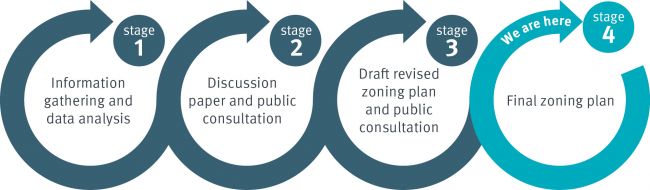
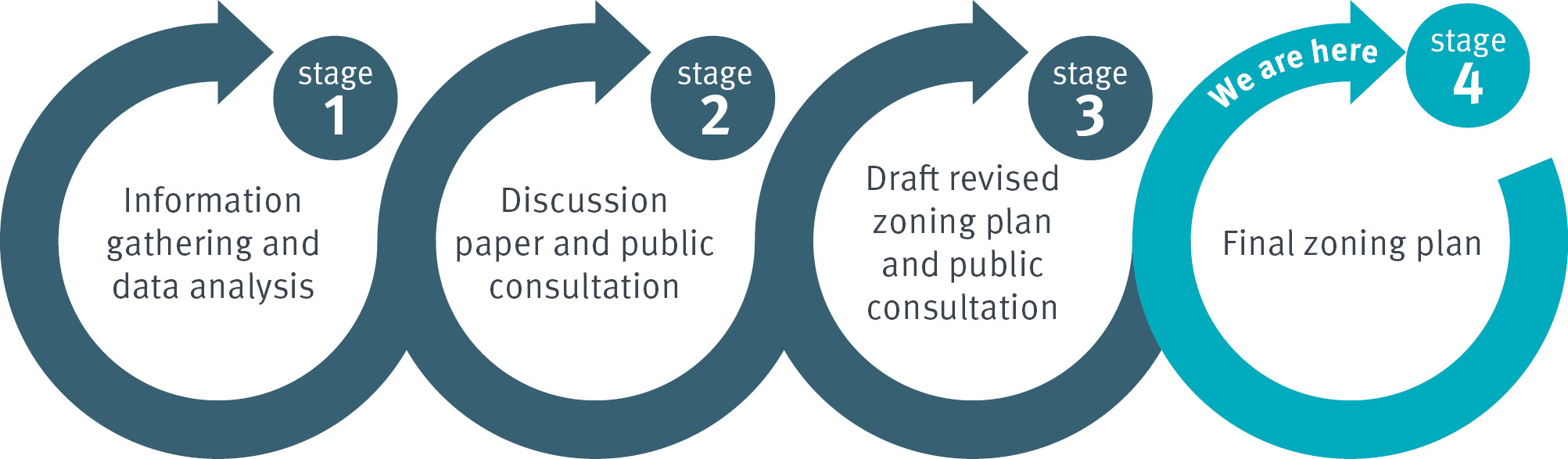
The review involved a four-stage process:
Stage 1: Information gathered about the conservation, social, cultural and economic values of the marine park.
Stage 2: A discussion paper released to gain public feedback on the management of the marine park.
Stage 3: A draft zoning plan and associated Regulatory Impact Statement released for further consultation and feedback in September–October 2022.
Stage 4: Informed by feedback from the consultation, legislation reflecting the outcomes of the review prepared. The new legislation was approved to take effect on 21 May 2024 following implementation of impact mitigation processes.
Consultation background
The department undertook a significant program of consultation with the community, First Nations peoples, local councils, scientists and key stakeholder groups on the zoning arrangements in the marine park, beginning in 2019
A draft zoning plan was developed, informed by community feedback, advice from First Nations peoples, recommendations from an independent scientific reference group, socio-economic information and scientific research, as well as best practice marine park management principles.
In developing the draft zoning plan, consideration was given to the primary objective of the Marine Parks Act 2004 to conserve and manage the state’s marine environment while providing opportunities for a range of ecologically sustainable uses by the community.
Between 23 September and 23 October 2022, the draft zoning plan and associated Consultation Regulatory Impact Statement outlining proposed changes was released for broad public consultation and feedback.
- Summary of key changes proposed in the draft zoning plan (PDF, 6 MB) September 2022
- Draft Zoning Plan Consultation Regulatory Impact Statement (PDF, 6 MB) September 2022
Stakeholders and the community were invited to have their say on how well the proposed changes would conserve and manage the marine park and/or affect them via an online survey or by submitting their feedback in writing.
Information about the draft zoning plan was distributed via traditional media, social media, newspaper and online advertising, email, posters, stickers and flyers, likely reaching more than 1.5 million people and generating more than 21,000 visits to the consultation website.
More than 443,000 of this audience was within the Great Sandy Marine Park local communities of Fraser Coast, Bundaberg, Gympie and Tin Can Bay.
How feedback was provided
More than 6,580 pieces of feedback were received, including:
- 1,245 submissions via the consultation online survey – over 59% from within Great Sandy Marine Park local communities of Fraser Coast, Bundaberg, Gympie and Tin Can Bay
- 215 written submissions, which included 2 form letters. The form letters produced by the Australian Marine Conservation Society and the Queensland Seafood Industry Association generated 4,227 and 1,066 letters respectively.
What the feedback said
Community and stakeholder consultation indicated strong support for the majority of changes that were proposed in the draft zoning plan.
In most cases the proposed changes were either supported as is, or with suggested modifications. These modifications mostly related to the location or boundary alignment of particular Marine National Park (green) zones.
The one key proposal that was strongly opposed by the majority of respondents (70 per cent) was the retention of commercial tunnel netting within the Conservation Park (yellow) zone of the Great Sandy Strait and Tin Can Inlet.
- The majority of people who completed the online survey chose to respond to questions relating to the revised zoning network and indicated strong and broad support for increasing protection of marine park habitats.
- Online survey results:
- 63% agreed with the proposed increase of the Marine National Park (green) zones from 3.9% to 12.8% of the park
- 79% agreed with proposed new or expanded Conservation Park (yellow) zones
- 75% agreed with proposed new or expanded Habitat Protection (dark blue) zones.
- The recreational fishing sector provided the majority of survey consultation feedback and were broadly supportive of the draft zoning plan but suggested several modifications to reduce impacts on recreational fishing access at some key fishing locations.
- Commercial fishers, seafood processors and various support industries strongly opposed the proposed changes to the zoning network and in particular, the prohibition of large mesh gill nets and ring nets from the Conservation Park Zones within Baffle Creek, Elliott River, Burrum River system, the Great Sandy Strait and Tin Can Inlet, due to the significant impacts on the local industry.
- The conservation sector provided clear support for most of the proposed changes and made suggestions to further enhance marine conservation.
Following the review process, the new zoning plan was approved to take effect 21 May 2024.