Seabed mapping
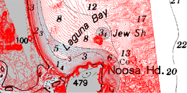
The propagation of a storm tide is sensitive to the underlying bathymetry (seabed).
This makes high-resolution mapping of near-shore bathymetry necessary for accurate hydrodynamic (water movement) modelling.
In Queensland, we have limited bathymetric data due to costs—gathering this data across our entire coast has been estimated to exceed $70 million.
To help address this knowledge gap, we conducted a pilot study in 2011–12 on the Sunshine Coast in collaboration with the Cooperative Research Centre for Spatial Information and the former Australian Government Department of Climate Change and Energy Efficiency.
The aim of the study, called Queensland Coastal Risk and Bathymetric LiDAR, was to provide useful evidence to inform future data gathering by considering:
- the methods and technology available
- the relationship between the accuracy of the bathymetry and our confidence in the modelling outputs.
What is LiDAR?
Light Detection And Ranging (LiDAR) is a detection system that employs the principle of radar but uses light from a laser to produce a 3D model.
Bathymetric LiDAR determines the depth of water from the reflection of the sea floor of a green laser, which is also capable of capturing land topography.
Height data are determined using onboard global positioning units.
How does it work?
LiDAR uses ultraviolet, visible or near-infrared light to image objects on the ground.
Lasers, carried on aircraft, are fired downward and the return pulses are collected in high-speed data recorders.
By comparing the transmitted and reflected pulses, and allowing for aircraft altitude, speed and position, the elevation of the ground can be obtained with great precision.
LiDAR produces a large, raw dataset that can be converted to an ordered set of points and then processed to produce a surface known as a digital elevation model.
Each of the LiDAR data points are classified into different features such as ground, vegetation and infrastructure.
A collaborative program between the Queensland Government and the Australian Government collected approximately 60,000km2 of LiDAR data.
Reports
To access our study reports, go to the library catalogue and search for Queensland Coastal Risk and Bathymetric LiDAR: A pilot study for collecting near-shore bathymetry.
This document includes:
- Appendix 1: Sunshine Coast bathymetric LiDAR acquisition—capture of high-resolution bathymetric LiDAR for the Sunshine Coast
- Appendix 2: LiDAR point classification processing services for Sunshine Coast—the re-classification of existing topographic data
- Appendix 3: UDEM: Hydro-DEMs, value proposition of L3 classification—the development of a seamless land and sea digital elevation model (HydroDEM)
- Appendix 4: The coastal storm tide inundation and floodplain modelling investigating the impact of high-resolution data on modelling result
- – Figures
- – Appendix A: LiDAR accuracy reports
- – Appendix B: Physical processes
- – Appendix C: Coastal storm tide inundation modelling results
- – Appendix D: Floodplain modelling results
- Appendix 5: Quality assurance of Sunshine Coast bathymetric LiDAR acquisition
- Appendix 6: Sunshine Coast LADS survey additional information—review of bathymetric LiDAR acquisition.
Bathymetric data
Use the Open Data portal to access the near-shore bathymetric LiDAR data.