Land zone definitions
Land zones are categories that describe the major geologies and associated landforms and geomorphic processes in Queensland.
The differences between land zones result in marked differences in the function of ecosystems and their associated biodiversity and this is due in part to the effects that geology (lithology, structure, alteration) has on landform, hydrology and landscape processes (geomorphology and soil formation).
View Land Zones of Queensland (PDF, 8.78MB).
Recommended citation: Wilson, P.R. and Taylor, P.M. (2012) Land Zones of Queensland. Queensland Herbarium, Queensland Department of Science, Information Technology, Innovation and the Arts, Brisbane.
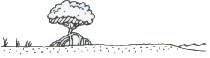
Land zone 1
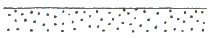
Short description: deposits subject to periodic tidal inundation
General term: tidal flats and beaches
Quaternary estuarine and marine deposits subject to periodic inundation by marine waters. Includes mangroves, saltpans, off-shore tidal flats and tidal beaches. Soils are predominantly Hydrosols (saline muds, clays and sands) or beach sand.
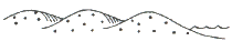
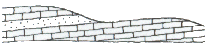
Land zone 2
Short description: Quaternary coastal sand deposits
General term: coastal dunes
Quaternary coastal dunes and beach ridges. Includes degraded dunes, sand plains and swales, lakes and swamps enclosed by dunes, as well as coral and sand cays. Soils are predominantly Rudosols and Tenosols (siliceous or calcareous sands), Podosols and Organosols.
Land zone 3
Short description: recent Quaternary alluvial systems
General term: alluvial river and creek flats
Recent Quaternary alluvial systems, including closed depressions, paleo-estuarine deposits currently under freshwater influence, inland lakes and associated wave built lunettes. Excludes colluvial deposits such as talus slopes and pediments. Includes a diverse range of soils, predominantly Vertosols and Sodosols; also with Dermosols, Kurosols, Chromosols, Kandosols, Tenosols, Rudosols and Hydrosols; and Organosols in high rainfall areas.
Land zone 4
Short description: Tertiary-early Quaternary clay plains
General term: clay plains
Tertiary-early Quaternary clay deposits, usually forming level to gently undulating plains not related to recent Quaternary alluvial systems. Excludes clay plains formed in-situ on bedrock. Mainly Vertosols with gilgai microrelief, but includes thin sandy or loamy surfaced Sodosols and Chromosols with the same paleo-clay subsoil deposits.
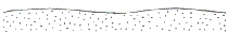
Land zone 5
Short description: Tertiary-early Quaternary loamy and sandy plains and plateaus
General term: old loamy and sandy plains
Tertiary-early Quaternary extensive, uniform near level or gently undulating plains with sandy or loamy soils. Includes dissected remnants of these surfaces. Also includes plains with sandy or loamy soils of uncertain origin, and plateau remnants with moderate to deep soils usually overlying duricrust. Excludes recent Quaternary alluvial systems (land zone 3), exposed duricrust (land zone 7), and soils derived from underlying bedrock (land zones 8 to 12). Soils are usually Tenosols and Kandosols, also minor deep sandy surfaced Sodosols and Chromosols. There may be a duricrust at depth.
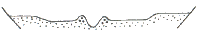
Land zone 6
Short description: Quaternary inland dunefields
General term: inland dunefields
Quaternary inland dunefields, interdune areas, degraded dunefields, and associated aeolian sandplains. Excludes recent Quaternary alluvial systems, which may traverse this zone, and intermittent lakes and claypans (land zone 3). Soils are predominantly Rudosols and Tenosols, some Kandosols and minor Calcarosols.
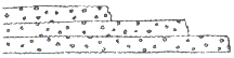
Land zone 7
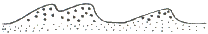
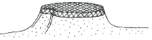
Short description: Cainozoic duricrusts
General term: ironstone jump-ups
Cainozoic duricrusts formed on a variety of rock types, usually forming mesas or scarps. Includes exposed ferruginous, siliceous or mottled horizons and associated talus and colluvium, and remnants of these features, for example low stony rises on downs. Soils are usually shallow Rudosols and Tenosols, with minor Sodosols and Chromosols on associated pediments, and shallow Kandosols on plateau margins and larger mesas.
Land zone 8
Short description: Cainozoic igneous rocks
General term: basalt plains and hills
Cainozoic igneous rocks, predominantly flood basalts forming extensive plains and occasional low scarps. Also includes hills, cones and plugs on trachytes and rhyolites, and associated interbedded sediments, and talus. Excludes deep soils overlying duricrust (land zone 5). Soils include Vertosols, Ferrosols, and shallow Dermosols.
Land zone 9
Short description: fine grained sedimentary rocks
General term: undulating country on fine grained sedimentary rocks
Fine grained sedimentary rocks, generally with little or no deformation and usually forming undulating landscapes. Siltstones, mudstones, shales, calcareous sediments, and labile sandstones are typical rock types although minor interbedded volcanics may occur. Includes a diverse range of fine textured soils of moderate to high fertility, predominantly Vertosols, Sodosols, and Chromosols.
Land zone 10
Short description: coarse grained sedimentary rocks
General term: sandstone ranges
Medium to coarse grained sedimentary rocks, with little or no deformation, forming plateaus, benches and scarps. Includes siliceous (quartzose) sandstones, conglomerates and minor interbedded volcanics, and springs associated with these rocks. Excludes overlying Cainozoic sand deposits (land zone 5). Soils are predominantly shallow Rudosols and Tenosols of low fertility, but include sandy surfaced Kandosols, Kurosols, Sodosols and Chromosols.
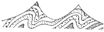
Land zone 11
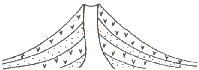
Short description: metamorphic rocks
General term: hills and lowlands on metamorphic rocks
Metamorphosed rocks, forming ranges, hills and lowlands. Primarily lower Permian and older sedimentary formations which are generally moderately to strongly deformed. Includes low- to high-grade and contact metamorphics such as phyllites, slates, gneisses of indeterminate origin and serpentinite, and interbedded volcanics. Soils are mainly shallow, gravelly Rudosols and Tenosols, with Sodosols and Chromosols on lower slopes and gently undulating areas. Soils are typically of low to moderate fertility.
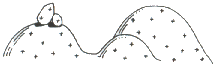
Land zone 12
Short description: Mesozoic to Proterozoic igneous rocks
General term: hills and lowlands on granitic rocks
Mesozoic to Proterozoic igneous rocks, forming ranges, hills and lowlands. Acid, intermediate and basic intrusive and volcanic rocks such as granites, granodiorites, gabbros, dolerites, andesites and rhyolites, as well as minor areas of associated interbedded sediments. Excludes serpentinites (land zone 11) and younger igneous rocks (land zone 8). Soils are mainly Tenosols on steeper slopes with Chromosols and Sodosols on lower slopes and gently undulating areas. Soils are typically of low to moderate fertility.