


About land use in Queensland
The Queensland Government maps and assesses land use patterns and changes across the state, according to the Australian Land Use and Management Classification. Government, the private sector, research agencies and community groups use the land use datasets for:
- Identifying agricultural production areas
- Statutory Regional Planning
- Identifying source of nutrients and sediments to support the Paddock to Reef Monitoring Program (P2R) as part of the Great Barrier Reef Water Quality Protection Plan.
- Coastal Management plans
- Prioritising investments and extension work across state and federal government agencies.
- Biosecurity —for example, outbreaks or diseases spreading across banana plantations in north Queensland.
- Assessing the impacts of natural disasters such as tropical cyclones
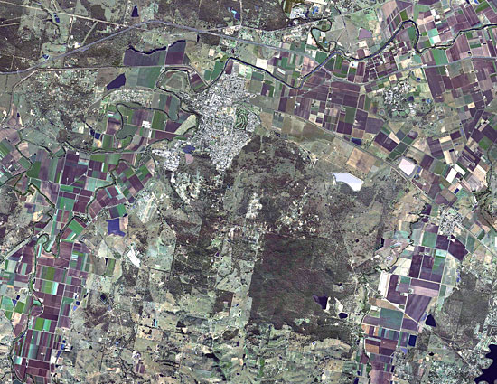
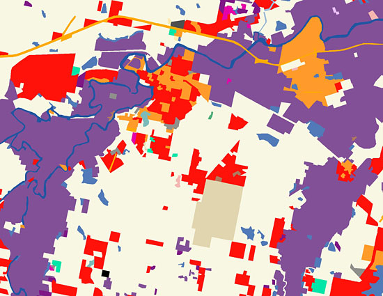
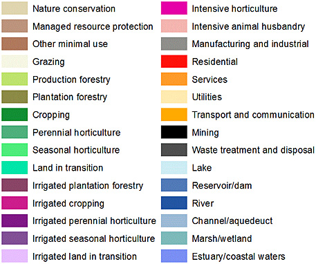
Fig. 1. An example of land use mapping for Gatton in South East Queensland (SEQ).