


October
About the image
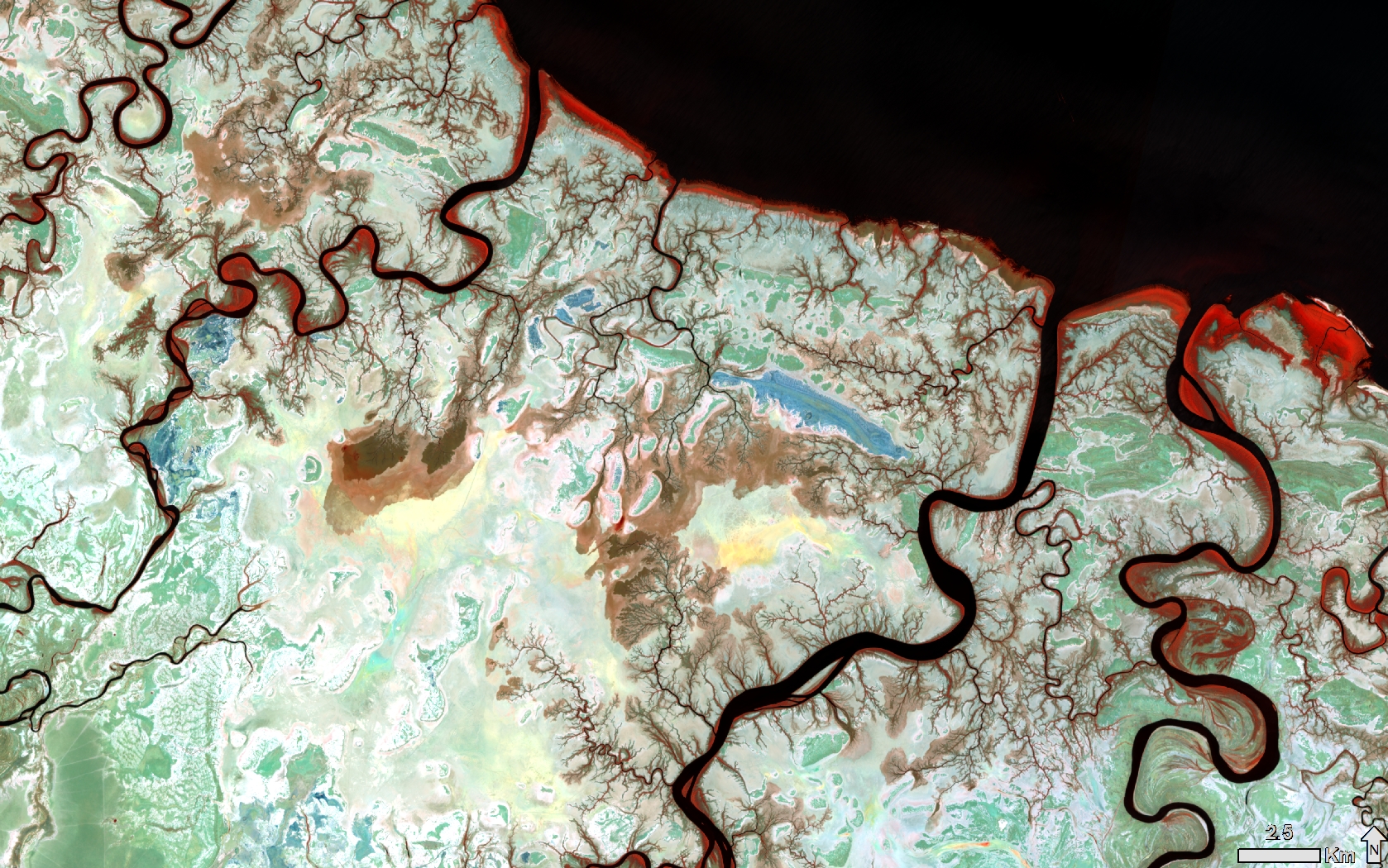
This false-colour Sentinel-2 image of the coastal area near Burketown, QLD, shows an artist’s palette of colours, due to the intricate tributaries, meandering channels, and expanses of salt pans and tidal flats. Mangrove forests appear as a striking red-orange hue in the inter-tidal zone. The patterns may be likened to blood vessels and capillaries in the venous system, or bronchioles in lungs.
Mangroves
Australian mangrove forests contain 41 species of mangrove from 19 plant families. More than half of the world’s mangrove species are found in Australia. Forty-five percent of Australia's mangrove forests are found in Queensland [1]. Mangrove habitats are present along much of Queensland’s coast, with species richness and abundance varying with tidal inundation and latitude. Mangrove roots trap sediment, prevent erosion, provide buffer zones from severe storms and cyclones, filter pollutants and cycle nutrients. Mangroves are efficient carbon sinks, sequestering carbon in their above-ground and below-ground biomass and sediments. Furthermore, mangroves provide habitat, food for migratory birds, estuarine and coastal fish species, molluscs and crustaceans. The protection afforded by inter-tidal mangrove zones provide nursery areas for many fish and crustacean species, including those of commercial importance, such as prawns. Healthy fisheries founded on healthy nurseries support commercial, recreational and indigenous activities.
In Queensland, mangroves are protected under the Fisheries Act 1994. However, mangroves continue to be threatened by coastal development and increased demand for aquaculture and agriculture products [2].
Since mangroves cover large areas and are often inaccessible, remote sensing is a key tool used to characterise mangroves, and to study the benefits that they provide [3]. A variety of approaches have been applied to remotely sensed imagery to monitor mangrove forests, and to assess their extent, composition, biomass, health and change over time. These quantitative assessments provide information about how mangrove forests survive in, and adapt to, changing conditions. The Queensland Government has been monitoring mangrove dieback and recovery in Northern Queensland, based on various sources of high-resolution remotely sensed imagery.
Technical details
The Sentinel-2A image was captured at 11:02am on September 4th 2020. The image is displayed using spectral bands 6 (red-edge 2), 5 (red-edge 1) and 3 (visible red) in the red, green and blue channels, respectively. This spectral combination renders mangrove forests in red and orange, salt pans and tidal flats in pale greens and blues and water bodies black. The image was supplied by the European Space Agency and processed by the Queensland Government's Remote Sensing Centre.
References
- https://www.agriculture.gov.au/abares/forestsaustralia/profiles/mangrove-2019
- https://www.daf.qld.gov.au/business-priorities/fisheries/habitats/marine-plants-including-mangroves/protection-management
- Pham, T.D.; Yokoya, N.; Bui, D.T.; Yoshino, K.; Friess, D.A. Remote Sensing Approaches for Monitoring Mangrove Species, Structure, and Biomass: Opportunities and Challenges. Remote Sens. 2019, 11, 230.