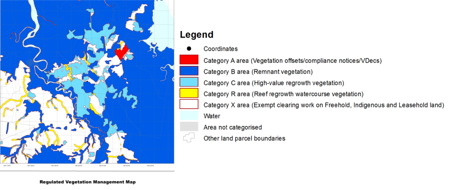
A property map of assessable vegetation (PMAV) is a property-scale map that shows the boundaries of vegetation categories on the property. Some properties already have a PMAV, but if your property doesn't have one you can apply for one.
Once a PMAV is certified, it replaces the regulated vegetation management map for determining the location and extent of the different areas of vegetation.
To confirm if a PMAV exists on a lot, landholders or potential buyers should request a property report or contact the Department of Resources.
When is a PMAV made by landholders
After viewing the regulated vegetation management map for your property, you may wish to apply for a PMAV to be created to:
- confirm the vegetation category areas as currently mapped
- amend the mapping if you believe there is an error.
In these instances, a PMAV is made through agreement between you and the Queensland Government.
When is a PMAV made by the department
We may place a PMAV over an area of land for other reasons, for example to allow an area to regenerate when it has been unlawfully cleared or to protect an offset area until it has reached remnant status.
How to apply for a PMAV
Complete the application for a property map of assessable vegetation (PDF, 304KB). Note: An application fee of Fee 6819 applies. We have prepared a PMAV application guide (PDF, 2.4MB) which provides guidance to landholders and consultants on information to include with your application.
Your application must also contain a map showing the proposed vegetation boundaries and categories. If required, you will also need to provide information to demonstrate that the proposed boundaries are inaccurate. The application form provides details of requirements.
What happens next?
Confirming the vegetation category areas as currently mapped
We will check that the application form has been completed correctly and the fee has been paid. If there are any issues with your application, we will contact you. Once we have all of the mandatory information we will certify the PMAV and send it to you.
Amending the mapping if you believe there is an error
We will assess your application using the information you supplied, as well as imagery and any other relevant data available to us. If we need extra information, we will contact you.
The department has prepared the following guide to assist you when preparing a PMAV application to modify category C areas:
After we have considered all available information, we will send you a draft PMAV or certified PMAV, depending on whether all of the changes requested in your application have been made. If proposed changes have not been made, we will provide you with information detailing the reasons behind our decision and offer you the opportunity to supply additional information.
If you are not satisfied with our decision, you can apply for an internal review (PDF, 189KB).
